Thursday, September 6, 2012

BUOYS RECONSIDERED!

A response from the U. S. Coast Guard Ninth District stated that
buoys #2 and #6 would be reset shortly. 
Detroit Harbor, Washington Island -

Word was received this morning that the U. S. Coast Guard Ninth District Waterways Management has reconsidered placement of #2 and #6, and will be conducting further study of Detroit Harbor aids.  The email exhange follows:

From: richard@wisferry.com [mailto:richard@wisferry.com]
Sent: Thursday, September 06, 2012 1:34 PM
To: Kugel, Ralph BOSN2
Cc: Hoyt Purinton; Rich Ellefson; Joel Gunnlaugsson
Subject: Re: Confrence call

Mr. Kugel -   I would like to add my thanks to your email response, for reconsidering the placement of Buoys 6 and 2 that we believe are of immense help to our ferry captains, and for your continued study and solicitation of comments regarding the Detroit Harbor waterway.  
  We understand that your organization's job, collectively, is to manage all of the Ninth District aids to navigation, no small task, and that as such it may involve more than we in our corner of Lake Michigan may appreciate.   If anything, this tells us we ought to make a more concerted effort to communicate with your office (and the other way around, too).   Again, our appreciation for your willingness to listen and solicit comment.
    -  Respectfully,  Richard Purinton, CEO, Washington Island Ferry Line, Inc.


On Sep 6, 2012, at 9:51 AM, Kugel, Ralph BOSN2 wrote:
Hoyt,

Thank you for all your input. We are going to step back and conduct a waterway study of Detroit Harbor. The study is currently being advertised in the Great lakes Notice to Mariner.  Comments can be made to Coast Guard Sector Lake Michigan in Milwaukee or myself. Your comments are very valuable in this study as they have been all along and we will continue to take comments until 01 January 2013.  We want to make sure that we get it right for all users. I have attached a survey that you could reproduce locally and hand out to marina patrons, ferry captains, other waterway users if you like. Mr. Doug Sharps contact information is located at the bottom of the survey. 

We are sending ANT Muskegon back out to put 2 and 6 back in the water. They should be there next week weather depending. 

Again, thank you for all your valuable input and local perspective. 

Ralph
*****   (With thanks to all who have commented with their support and advice... Following - printed BELOW - is a form supplied by Mr. Kugel that can be used by boaters and citizens to express their thoughts about aids to navigation in Detroit Harbor.   DP)  ***


Waterway Analysis and Management System Survey

Name of Waterway:_________________________________________

User Information

___Commercial User
___Recreational User

Name:________________________________________________________
Address:________________________________________________________________________________________________________________________________________________________________________________
Phone:________________________________________________________
E-mail address: ________________________________________________
Company/Employer:____________________________________________

Number of years in the maritime industry or number of years using this waterway:____________________________________________________
Number of transits in the waterway per year:________________________
Number of night transits of waterway:_____________________________
Seasonal Dates:      Start:______________End:____________________
Name of Vessel:________________________________________________
Vessel Description:_____________________________________________
Length:___________Beam:__________Draft:_________Gross Tons:_____
Net Tons:_________Bridge Height of Eye:___________________________
Cargo Carried:_________________________________________________

Navigational tools used: (ECDIS/ECPINS, GPS, DGPS,VISUAL, RADAR)_____________________________________________________________________________________________________________________________________________________________________________________________________________________________________________


What area do you believe is the most dangerous or difficult to navigate:_____________________________________________________________________________________________________________________________________________________________________________________________________________________________________________

Are the floating aids to navigation (lighted and unlighted buoys) adequate for this waterway:_______________________________________________
_______________________________________________________________________________________________________________________________________________________________________________________

Are the fixed aids to navigation (lights, ranges, lighthouses, daybeacons) adequate for this waterway:_______________________________________
_______________________________________________________________________________________________________________________________________________________________________________________

Are the year round and lighted ice buoys adequate:____________________
_______________________________________________________________________________________________________________________________________________________________________________________

Are there buoys that you feel should be changed to fixed aids to navigation:___________________________________________________________________________________________________________________________________________________________________________________________________________________________________________

Are there any buoys that could be eliminated from this waterway:________
_______________________________________________________________________________________________________________________________________________________________________________________

Are there any buoys with sound signals that the bell or gong could be removed:______________________________________________________
__________________________________________________________________________________________________________________________

Are there any areas that require additional aids to navigation in this waterway:_______________________________________________________________________________________________________________________________________________________________________________
Do the nautical charts, Coast Pilot, and Light List meet your needs for this waterway:____________________________________________________________________________________________________________________________________________________________________________________________________________________________________________

Are there private Aids to Navigation that you find misleading or interfere with the current system in the waterway:_____________________________
_______________________________________________________________________________________________________________________________________________________________________________________

Any addition comments on this waterway:___________________________
________________________________________________________________________________________________________________________________________________________________________________________________________________________________________________________________________________________________________________________________________________________________________________________________________________________________________________________________________________________________________

Thank you for taking time to comment on this waterway.  Your input as a mariner very valuable to the U. S. Coast Guard in evaluating waterways to make them safe and as easily navigable as possible.  Please fell free to contact Mr. Doug Sharp at william.d.sharp@uscg.mil or (216) 902-6070 with any other questions or concerns about any aids to navigation in the Great Lakes.


Wednesday, September 5, 2012

LATE LABOR DAY RAIN

Rain clouds brought welcomed moisture to northern Door County
late Labor Day Monday afternoon.

Detroit Harbor, Washington Island -

There's something about watching a thunderstorm develop in the west, the energy of white clouds lifting and rolling at the lip, dead silence for a short time before the wind shifts from the direction of the storm, then peals of thunder and torrential rain.

Its a powerful experience, one we haven't witnessed for awhile, and it came at the end of the afternoon of Labor Day.  Ferries had already delivered weekend visitors to the mainland, those returning to their homes to begin work or school the following morning, and except for golfers in the Monday men's league at Deer Run who may have scattered indoors, this storm and the moisture it delivered came with perfect timing.  The weekend - the whole preceding week, for that matter - had excellent weather, sunny skies, temperatures that ranged in the 70s.  We could smugly say how happy we were to be living here.  Then the weekend, too, was ultra-fine, the type of weather any visitor can appreciate, for any sort of activity, with a full moon - a blue moon - that beamed upon the waters of the harbors, fields and pastures.

According to several people with home rain gauges, precipitation ranged between 2-3".  John Delwiche, official Island Weather Observer for NOAA who lives near East Side Road, measured just under 2" as an official Washington Island entry.  But, John acknowledged that a mile this way or that could have easily made the difference of half an inch or more, so concentrated were the downpours.
(John's synopsis for August indicates that total Island August precipitation was 29% of the past 30-year average, and it was the 4th driest August since 1945!)

Will this rain help lake levels?   Certainly, though it was quite concentrated in the northern lake region,  will make some difference, but just how much is hard to say.  There is a lot of lake to fill, not to mention swamps, ponds, creeks, the water table underground, and so forth.   A wet fall from here on can only serve to benefit the overall level, however.

Monday, in what we observed as a good trend, the lake level increased a few inches, enough to sneak out for a sail without getting stuck.  We hope that level holds for awhile.

- Dick Purinton


Tuesday, September 4, 2012

BACK WHEN MEN WERE MEN!

Early chart of Detroit Harbor, from 1928 Light List,
courtesy of Eric Bonow. At that time, wooden ferries

crossed the harbor to land at the shipyard.


Washington Island, Wisconsin -

We've been awaiting word from the U. S. Coast Guard Aids to Navigation representatives in Cleveland regarding our request for them to reconsider their policy for the intended, permanent removal of several steel floating aids to navigation in Detroit Harbor.

Late this summer we learned that all of the steel "ice hull" buoys would be pulled and then replaced with lighter, floating aids on a seasonal basis.  This action would mean no floating aids to rely on for approximately five months of the year, including winter, and full reliance would necessarily shift to the two newly constructed cylinders and the long-established "tripod" entrance marker.

We had the opportunity to discuss our point of view in a phone conference with three Coast Guard officers who represented Ninth District Aids to Navigation, Cleveland, two weeks ago. We're hoping the intervening period of time brought about a change of policy regarding those buoys, aids that we consider critical for year around, daily ferry operations.

Boiled down, we requested that buoys #2 and #6 be reset for year around use.  Such steel buoys are superior radar targets in fog or snowstorms over the smaller foam buoys, we said, and they always provide important visual reference for our ferry captains.  We offered to assist with buoy setting using one of our ferries, if that were helpful, but we learned that there is a policy to not rely on such civilian help, or mix private aids with approved federal aids.

Of concern to us was that we had to repeatedly make our case, in several different ways, to be clear that those buoys are not just a nicety but critical to repeated, safe transit of the channel in varied conditions.   Those new, large cylinders will provide strong visual and radar targets, we agreed, but there is nearly a 1/3 mile gap between entrance mark and the first cylinder, a time when an operator, attentive to his compass course, depth, GPS, radar and throttles, must use all of his senses at once to maintain safe course.  Those floating buoys provided excellent visual reference when nothing else was available.  This was certainly true for #2 buoy, but equally important for #6 that marks the reef opposite the ferry dock.   Our ferries need to avoid this rock pile (now only several feet beneath the surface) each time the captain squares away on an outbound course.  High winds, occasional current, and ice in the channel can add difficulty to what is essentially a visual piloting exercise.

We got the impression though our prolonged discussion that we needed to toughen up and get used to relying on the Colusus of Rhodes columns that stand tall over our harbor. We regret having sounded argumentative during the 75-minute phone conference, but when it turned into a debate on what the purpose of a buoy is, and how we ought to be able to safely navigate the channel without floating aids, was there a better way we could have gotten our points across?

The two buoys (#6 and #2) that we described as essential for our safe operations are already here on the island with their sinkers.  The vessel that services them from Muskegon, and the sailors who man that vessel, are available and have already been funded.  That leaves the cost of fuel and the orders to sail a 46-foot vessel across the lake every two years for buoy maintenance as the sole "obstacle," apparently.  That vessel has limitations placed on its scope of service that make such a voyage in open water a violation of its intended use in protected waters.

It may indeed be time to toughen up.

In this photo the C. G Richter was still the winter
ferry, but it does point out the rather small, constricting
basin in which  to turn around or maneuver.  At the
top right of the oval is the red nun #6, marking
the shallow reef.
Others used to do it!  Why can't we?

Back in the days of sail and small mechanized freight boats, called hookers, there were but a few channel aids to assist them. That channel was natural, like a river, and not mechanically dredged.

Eric Bonow, as he has done many other times, sent along information in the form of a chart of the Detroit Harbor entrance from the 1928 Light List.  It may be one of the earliest that depicts buoys marking the West Channel.  At the outer end is the gas buoy with bell which then marked the south end of the shallow reef (rather than sitting on top of the north end as does the present day entrance buoy.)   A bit farther in was a black can where the channel took a slight dipsy-doodle.

Another aid, called the "elbow light" on the old chart where the channel crooked off to the east, marked what Nathan Gunnlaugsson called the "false channel."  A crib of stones marked this naturally deep route, and the mark's remains, a rock pile with a single, upright timber protruding from it, still shows itself to this day east of the dredged channel.  To the west of that crib and the false channel is a two-foot shoal, presently marked by the #6 red nun foam buoy.

From my perspective, the channel then was minimally marked, and it must have been a tense time when vessel masters entered or left port.  Maybe they produced greater testosterone than we do today.
The frequency of modern day ferry travel to and from Detroit Harbor, and the consequences for striking bottom (which includes reporting such incidents to the Coast Guard, and the possibility of haul-out for repairs) won't be satisfied by an old-fashioned spit of plug juice over the side or the vow to do it better the next time.

If we read our regulators' remarks correctly, now is the time for us to toughen up, sharpen our boat handling skills, and be thankful for all we've been given from our federal government!

We hope to bring good news to our readers when such news is available. - Dick Purinton

A few additional thoughts...

Several comments have already been received by direct communication regarding the above essay, and one of them was a comment on the Coast Guard's preference for the installation of "gated" buoys whenever possible.  And while in general this practice may be a proven benefit to navigation, providing a guide for both sides of the waterway, in the case of Detroit Harbor there were only the red floating buoys, for decades, in addition to the green entrance buoy.  (And also the exception of #9 placed at the north end of the channel in the turning basin, now replaced with a white and red striped buoy).   Later, about the year 2001- which happened to coincide with a completed, major dredging project in front of our island ferry terminal - green can #5 was installed.   It proved beneficial as a turning mark for our ferries, marking the shallows along the west side of the channel much in the same manner #6 now marks the hump on the east side of the channel.  But, cost and engineering overkill aside, that new cylinder #5 does not appreciably aid navigation because even though such a "gate" of cylinders may look good on paper, it becomes an immovable obstacle both for vessels and for ice.  And when you're coming into the harbor in low visibility, by the time you're near #5 you've already got a visual bead on the end of the ferry pier.   We're hoping winter ice will not be held back by that cylinder.

The other comment had to do with the new, foam buoy #6A placed approximately one month ago at the north end of the "hump," opposite the ferry landing.    This buoy #6A was installed as a response to several groundings by sailboats as they cut #6 too close to starboard and headed directly for #8 buoy over the top of the hump, with the intention of motoring into the harbor itself.   We don't object to #6A being added, if it helps recreational boaters.  But when asked our opinion during our conference call, we suggested moving #8 further west, so that navigators of recreational craft could, more or less, continue on course beyond #6 to #8 and thereby miss the shallows.  Instead, it appears the Coast Guard proposes the reposition #6 (thus "saving" another foam buoy, #6A).  This proposal, we emphasize, is an entirely wrong and is a potentially dangerous move as it will expose the south end of the shallow hump, which our ferry captains depend upon for visual positioning as they come into or leave their landing area, in both instances while engaged in a major turn.

We spoke up, and we hope notes were taken in Cleveland, because we did not acquiesce on this point regarding the importance of #6 being where it now is, for here and evermore, winter and summer, using a steel "ice hull" buoy.   -  DP

Friday, August 31, 2012

LOW WATER TODAY

Detroit Harbor, north end - 2:30 pm, August 31, 2012
Washington Island, Wisconsin -

The low water today marked a low for the year, as far as we're able to determine, and it raises serious concerns regarding loading and unloading of ferries at the island and at Northport.

If memory serves us well, the lake levels generally go even lower on a gradual basis, from this point to approximately the end of the year.   How much lower is anyone's guess.  Recreational boaters, and I am one, have already noticed the drop in lake level.  The sailboat that I thought would easily get in or out of the harbor scraped mud Wednesday when I motored toward open water.  Today, I would not be able to depart or return.  I'd run aground trying.  The key for my sailing will be to wait for a strong, very strong southerly wind that will push along enough water into Detroit Harbor, so that "the next time" will lead to haul-out for the season.  But that is a problem that doesn't impact others, except for fellow boaters.

Algae line shows unofficial drop of around ten inches since season high.


What we'll do with the ferries when water drops even lower may mean special loading considerations, until we're able to adjust ramps further.  Doing so may mean knocking out concrete, cutting steel, and looking ahead to a new low level several months from now.   Better yet may be to consider a much longer-term solution, but that will require permits and some expensive, time consuming construction to provide greater flexibility in loading.  Were these requirements for passengers only, it could be done using a floating stage.  Even with autos, the requirements aren't overwhelming.   But when heavy semis are considered, the ramp situation becomes both an engineering and financing challenge.  And, none of the shore ramp modifications address what could ultimately become shallow maneuvering area.

Stern ramp of the ferry Robert Noble is lower than the other ferry ramps, and the air gap shown
here between underside of ramp and the concrete of the pier 
would 
reduce to zero clearance with a full vehicle load and associated passengers standing aft.
Our ability to load ferries, one right after the other or simultaneously, speeds up the movement of traffic on busy days.   This feature of service may be lost until ramp improvements have been addressed, or water levels rise.

Fortunately the successful passing of this weekend will mark the start of fall, a period of operation with a slower pace and a lesser ferry schedule, a breather in which to better assess our options.

-  Dick Purinton

Comprehensive Conservation Plan Out For Review

Aerial view of Plum Island looking west.  
(Photographer unknown, thought to be a FOPPI file photo.)
Washington Island, Wisconsin -

The U. S. Fish and Wildlife Service (USFWS) just released their long awaited draft of the Comprehensive Conservation Plan (CCP), a plan that includes Plum, Pilot, Hog and Gravel Islands.

Of special interest to many people who enjoy natural history, geology, underwater and land archeology, and the encompassing maritime history of these islands, will be the plan pages that relate especially to Plum and Pilot Islands.  This is a very comprehensive document indeed, and it's not hard to understand the time it took to assemble this document and obtain various department approvals prior to public input.  Besides the islands mentioned above, this document is also a CCP for the many other islands in the upper Great Lakes area that also come under management of the  USFWS Regional Office in Minneapolis.

You may want to begin reading this as soon as possible, given its length.  Public comments on this document are due by September 23, 2012.   Written comments can be mailed to the USFWS address at:

    USFWS, 5600 American Blvd. West, Suite 990, Bloomington, MN  55437-1458

Or, you may email comments to:    r3planning@fws.gov    (put "Great Lakes Island CCP Comment" in the subject line.)

The actual document can be viewed at:      http://www.fws.gov/midwest/planning/GreatLakesIslands


Plum Island boat house (exterior refinished) - FOPPI photo
Highlights and pleasant surprises

Plan highlights regarding the future of Plum and Pilot have indeed included the prospect for visitation on Plum Island, with the creation of nature trails, the planning for an interpretive center, the continued restoration of buildings there, and the acknowledgement of the need for more work on the part of volunteers. The extensive work list now being tackled by the many members of the Friends of Plum and Pilot Islands (FOPPI) may seem almost without end.  Work already accomplished is a good start, but it's only the very beginning.  That's when people like Tim Sweet, FOPPI President, with his leadership and vision, can instill energy and enthusiasm in others, and present an orderly, longterm process, the results of which older citizens and members of FOPPI might never see.

But we need to start somewhere and the USFWS, by and large, with this plan draft has recognized both natural and human (cultural) benefits these islands have to offer.  This ongoing project is important, we think, for future generations of children who might ask: "What are cormorants?"  "What's a lighthouse?"  ... not to mention the future appreciation and understanding for the century or more of commercial shipping propelled with canvass and steam that sailed through this passage between bay and lake.  (I was reminded how quickly dated design and technology can become when my grandson pointed to the window crank on the 1985 Jeep Cherokee I was driving and asked, "What's that?"  Of course, in his  nine years he had only known electric window buttons and door locks.)

In order to read the most pertinent information for Plum and Pilot Islands you can fast-forward using the table of contents as your guide.  Much of the information I read is concentrated between pages 49 thru 55.   There, Cultural Identity, Objectives and Strategies are outlined.   But I think you will also want to read or at least skim the other pages, too, for interesting background information on surveys of plant types, birds and animals found on these islands.  It adds to the depth of our understanding, and greater appreciation for the job of the USFWS staff.

Pilot Island with dead cedar trees  (photographer unknown)


If there is one facet of this plan I found still disappointing, it was the passive approach to cormorant nesting on Pilot Island, and comment indicating that these birds may no longer actively nest there.  Not so, from what we've seen and heard from others.  If ongoing study of these birds is of such great importance, then let us in on the study parameters and objectives.   If counting of these birds is the extent of study, what has been the historical tally of nests and of birds found there, and how will letting this island be a bird island exclusively - an an extremely important protrusion of rock with maritime buildings, from an historical point of view - how will this further enhance our knowledge of those birds?  Are there not other suitable island locations nearby from which they also have opportunity to eat fish and reproduce, but which have had no similar human historical footprint?

Nesting cormorants dictated Pilot Island's
recent past, and perhaps they will dictate its future.
Well, those are my comments in a nutshell at first reading, but I will take a second and third look before committing pen to paper.  In the meantime, there is a USFWS Open House - a listening and conversation session - scheduled for the Island Community Center's Rutledge Room, Monday, Sept. 10th, between 5 pm and 8 pm.  This will be an opportunity to ask questions of USFWS refuge staff, and to submit comments if you wish.  Comment forms will be available there, so that written comments can be submitted there, or mailed in later.

This draft CCP is an important document that should receive attention from every citizen with an interest in the islands, their environment and local maritime history.

-  Dick Purinton

Tuesday, August 28, 2012

SUMMER SAILS ALONG

An afternoon sail with Steve Schwandt
Detroit Harbor, Washington Island -

I received a few emails from regular readers of this blog, which in itself is a great ego boost to know folks notice when I don't write!

A few thought my lack of frequent postings may have been prompted by health reasons (and I think they may have been right - a streak of laziness!) since there was only one blog since July 5th, and that one blog was about the buoy situation in Detroit Harbor.

My lack of frequency really had more to do with the many things going on here, both work and play, that the idea of a blog just took a back seat to those other activities.  But that's how summers are,  packed with lots of activity:  work (in my case a long stint as Cherry Train driver / narrator) and family.  I've also been a regular contributor to the revamped Island Observer, our community newspaper.  In a way, that writing competes for my urge to write something here every so often.

A plug for the island newspaper

I may as well use this opportunity to recommend - for those not already subscribers - that readers of this blog consider also taking out a $30 subscription to the Island Observer, if they are not already subscribers.  It's a great little newspaper with varied topics, filled with community information, generally upbeat in tone, accurate reporting of island news, with important background on unfolding news.    If you change locations several times each year as many readers do, just let the Observer office know where & when to deliver.   A great many people are working behind the scenes, both on the business and the editorial end, to bring a quality product to you.  Numerous friends I am aware of have renewed their subscriptions after a long absence, and in a few cases (which always surprises me) they've signed on for the first time.   I happen to think it is the quality of contributing writers and the strong editorial direction of Managing Editor Mary Marik that has made the greatest difference, but in fact, this has been a team effort from many, including folks behind the scenes you may never hear about.  It is, in my opinion, a great small newspaper success story these first six months under new ownership and management.

Island's BBQ a success 

The Death's Door Barbecue (DD-BBQ) held Saturday at the Island airport drew 25 contestant teams as well as many Kansas City Barbecue Assn. certified judges, plus hundreds of members of the public who did their own private assessment of barbecue product, fresh from the smokers and grills.  (Do they use grills?)  The Lions Club set up their big tent at the end of the runway, anchor for many of the food-related activities and booths, while the teams with their specialized sauces and rigs were tucked around the fairway between rows of hangars.   This was a community event in every sense of the word, headed up by a committee that had been hard at work since the snow began to fly last December.  Many people and organizations, including the Town of Washington and the REA, contributed.  Their hard work paid off, without question, and the day's weather cooperated to provide an activity that visitors and local residents enjoyed.

The 2012 DD-BBQ may well be the start of a new, annual island summer activity.  Event organizers will certainly refine their ideas for hosting this event based upon this first experience, so that increasing numbers of visitors may be attracted and entertained.  We heard "well done" from many.  (They referred to the event itself, and not the brisket and ribs.)

In like manner, thanks should also be given to those many other island organizations that host events during the year, too many to list here without risking leaving someone out.

But, a special note of recognition should go to the Lions Club members for their annual sponsorship of the Island Fair with its strong community-based activities, such as the Main Road parade, the bingo tent, providing the framework for many others to build upon.   This year, just weeks before that event, Club members installed new electrical service and water for the various games, food booths and other activities set up on the school grounds.  This installation replaced the multiple extension cords streaming from receptacles, overloading that often blew circuit breakers.  This was a very timely and considerate project on the part of the Lions.

And buoys are still not resolved

Amid the range of summer activities, and the ferrying of people and vehicles, came the controversy over removal of buoys in Detroit Harbor.  A discussion with several officials from Cleveland's Ninth District last week, August 21st, brought some hope that at least further review will be given.  But as of this moment, no word has been received.

Late summer's water levels continue to drop.  Mud flats were exposed in the shallows since the last major high pressure system blew our water to Muskegon and Charlevoix.  I hadn't seen that much mud since last January.   Where did the water go?  Why doesn't it blow back toward us?  What will we do if we don't get dredging help to deepen the channel?   How, in all of this, will two large cylinders replace the several floating navigational aids we formerly used to stay within deep water?

A number of issues, and many of these are controllable by man through policy and funding.  We hope to be able to report positive news at some future date.

Labor Day, the big wind-up to summer, is just around the corner.   I've got a seat with my name on it - upper bleacher, back row - at the Red Barn, to see Eric Lewis and friends Friday night.

Its fortunate we're offered so many choices on Washington Island, deciding when and what to participate in.  Thanks to all the people who work behind the scenes for these offerings of quality and variety.

More blogs to follow...promise!    -  Dick Purinton

Thursday, August 9, 2012

NAVIGATION PUZZLEMENT

Detroit Harbor buoys and sinkers offloaded at the Potato Dock August 8th.

DETROIT HARBOR, WASHINGTON ISLAND, WISCONSIN -

As a ferry operator, my greatest tension came when entering the Detroit Harbor Channel in heavy fog or blinding snow.   Finding the entrance mark, knowing I was where I was supposed to be in relation to the dredged channel, was an enormous relief.

A most reassuring moment was the visual sighting of buoy #2 by a crew member, followed by buoy #4.  We considered ourselves "home" once we were inside the end of Kap's Marina dock, and from there, the outline of the ferry dock was generally visible.

If the Coast Guard's long range plan for Detroit Harbor's navigational aids proceeds, then in cold weather months we'll have no floating buoys to help us.  The Coast Guard will remove temporary, seasonal buoys made of lightweight foam sometime in November, resetting them again in spring, so that they won't have to deal with the steel buoys, ground tackle and heavy sinkers.  In the interim, we'll have to learn to split the difference between the new cylinders that bracket the channel like the Colossus of Rhodes.  There will be a gap between cylinders #4 and #5 and the entrance tripod where no aids will mark the 150-foot wide channel.

This plan was revealed by the Coast Guard Tuesday through questions asked of the crew who came from Muskegon in their specialized aids-to-navigation maintenance craft.  By Wednesday morning they  had already pulled #6 buoy opposite our ferry dock.   (The crew is shown in the photo above depositing steel buoys 2, 4 and 6, along with sinkers on our Potato Dock property, where, I was told by Bosun Mate Chief Barra, the cutter Mobile Bay would moor to remove them from Washington Island.)

What will replace them, I asked?  Chief Barra, following orders to remove the steel "ice hull" buoys until told otherwise, said that foam-filled buoys would replace them until the late fall.

What will we do then, I asked?  Chief Barra said we would have the new navigation poles (the 20-foot poles atop the cylinders) to help us, and that "we've done the best we could."

If the plan to construct the two new cylinders in the harbor, aids #4 and #5, came to us as a surprise and  a curiosity in June, this new revelation caused even more surprise, along with consternation.   Why would the Coast Guard build two very expensive cylinders (at a cost approximating a half-million dollars), and then proceed on a plan to pull the steel "ice hull" cylinders on which we, as primary user of this dredged federal channel, depend for safe navigation in winter months, we wondered?

Their answers, we think, come from institutional decision making in Milwaukee, Cleveland, and perhaps Washington, based upon projected long term costs to maintain buoys in Detroit Harbor and the (perhaps) limited life of the Muskegon specialized nav aids maintenance craft. This vessel  powers across the lake each summer - as it has for the past number of years - to lift and inspect buoy chain, anchor fastenings, repaint buoys and reset the aids.  A presumption on our part is that the efforts made to save money on the annual District budget, coupled with the practical matter of lifting and maintaining the heavier steel buoys led to the solutions now evident:  permanent structures and seasonal, lighter foam buoys.

What is missing?

It is impossible to fault any single individual for a decision made over time because input has doubtless come from numerous, expert sources within the Coast Guard organization.  Rather, these decisions seems to us, frequent users of this waterway, an institutional failure to include the opinions of those upon whom such decisions can make a huge impact.

We have no idea of the cost involved in maintaining the old floating steel aids, life as we knew it for so many years, versus the cost of building new cylinder bases with light poles (at half a million dollars), and so it is hard for us to compare costs, one way or another, other than to say, that was a huge chunk of taxpayer money spent on cylinders.   And one of those cylinders, #5, is nearly useless in terms of its importance to channel navigation because of its position.  It would have been far superior had it replaced buoy #2, so that a line of marks could be used for navigation.  Had this been done, we would have less reason to squeal now about the pending loss of floating aids for six months of our operating year.

Only a few years back, the Commandant of the Coast Guard ADM Thad Allen, in his annual statement on  Coast Guard operations, admonished his organization to "Honor the Mariner." By this he meant: to listen; to engage in dialog; to not make hasty assumptions that might make matters worse for the maritime community.

We've seen great improvements since his statement was publicly made, most notably in mariner licensing where six months to get a license renewed was standard practice and mariners were advised to begin their renewal process for a five-year license a good year in advance of the expiration date, just in case.  Rich Ellefson told me just the other day that his renewal application had been approved, along  with official notice to him, within one week of his mailing!

Our frustration with the buoy change-out is coupled with our difficulty to communicate our concerns to someone in the Coast Guard - anyone - with authority to listen and address the Detroit Harbor situation.   It seems that the various names and phone numbers we had led to messages announcing personnel on vacation, on family emergency leave, on temporary duty elsewhere, and in the case of one officer I had met and knew, his voice mail box was full and I was unable to leave a message.

It was only after many calls were made that a call was finally returned to Hoyt Purinton of WIFL.  By this time, our greatest hope was to simply keep the removed buoys here, stacked on Washington Island's shore, so that if resetting is approved, the Coast Guard will not have to go to Sturgeon Bay or somewhere else to retrieve them.

And, if cost is a major consideration in Detroit Harbor's plan, as it must be, why not consider privatization of navigational aid maintenance?  I suppose there may be some Federal Code that limits service of navigational aids to the U. S. Coast Guard, but maybe it't time to reconsider that policy.

I observed the seven-man Coast Guard crew struggling to off-load buoy and sinker on our Potato Dock, and I found it hard to believe this could not be achieved locally with a barge and backhoe or other more specialized, private marine equipment, with greater economy.  It wasn't but a few years ago our company got chewed out for resetting harbor buoys to positions where they did us the most good, so far were they from their proper and useful positions.  Given frequent winter buoy drift in ice, our actions were essential to avoid running them over with our propellers, or running ourselves aground to avoid them.  We didn't mind the inconvenience of the task, and we believed we saved the Coast Guard an unnecessary trip to Washington Island, or so we thought.


Given today's GPS instruments and available commercial lift equipment, surely it is possible for a contract to be privately let that will specify annual maintenance and placement of buoys and sinkers.

As of late Wednesday, August 8th, Ferry Line President Hoyt Purinton was told by a Ninth Coast Guard District Waterways Management representative that the Detroit Harbor situation would be discussed via phone conference on August 20th.  There is no guarantee that a change in plans will result, but we're hoping that common sense will prevail.  We've made an assumption here that as a ferry transportation company, we also speak for those who rely on our services and our reliability to make ferry trips safely in all weather conditions, and that "improvements in navigation," whether viewed up close or from afar, should not pose greater risk to those dependent upon water transportation.

- Dick Purinton

Thursday, July 5, 2012

DREDGING HOPES CONTINUE

Virtually every commodity needed to sustain the 
Washington Island community is transported by ferry, 
in addition to daily carriage of vehicles and passengers.


Detroit Harbor, Washington Island -

Were it not for regular ferry service, island commerce and island living would be much different.  And were it not for a serviceable entrance to and from port, with sufficient depth to permit frequent and safe passage, that lifeline ferry service could be interrupted.

The Town of Washington's recent application for a Wisconsin Dept. of Transportation (WISDOT) Harbor Assistance Program (HAP) grant was turned down, but there are several reasons to remain optimistic, and to redouble efforts in obtaining project approval.  The elements are in place and a base of knowledge has been gathered.  It's a matter of finding the right funding sources, or combinations of support, that will move the project forward.   

Recent discussions by state and federal officials concerning the Town of Washington's application for dredging, at a meeting held in the Rutledge Room of the Island Community Center, Friday, June 22,  recognized the potential calamity that suspended or restricted navigation would cause should the lake level continue to drop.  It was further recognized that at this point there is no imminent danger of ferry service interruption due to depth, they said.  And an increase in channel depth through abundant rain and snow fall could also occur.  But it is just as likely the lake level could drop even further.

The funds that were requested to execute this dredging project, approximately $7.6 million,  exceeded the WISDOT HAP dollars available.  There were five other project applicants after those same dollars, and the available funds were split among three applicants.  One or more applicants had been rejected for a previous application.

The Detroit Harbor project, in order to be accepted, would either need to be scaled back, made less expensive, or applied for in two, separate funding cycles.  A stronger and more conclusive case also needs to be made for getting this work done now, before lake levels drop further.

The possibility of funding with tax revenues from two fiscal years is being reviewed for feasibility. There is extra cost in mobilizing equipment for two separate project contracts.  Doing so could also impact island roads over a longer period of time with heavy truck traffic.

There were questions regarding the Town's project application.  A crisis is not yet at hand, but is there a likelihood a low water crisis could occur in the next year or two?   What do long range lake level predictions tell us?   The general consensus among members of the citizen review was that this was a worthy project.  But in order for this to proceed, further engineering needs to be furnished to arrive at more exact dredge spoil quantities.

Another question asked was, what type of bottom material would be encountered?   Might this channel accumulate silt within a 10 or 20 year period and have to be dredged again soon?   From dredging experiences and from numerous core samples that have already been taken, sediments of rock, clay and muck predominate.  There is no sand or gravel.  There has been no silting since the federal channel was dredged in 1937.   Would the type and quality of dredged material be useful for beach nourishment?  The likely answer to reusing dredge spoils on beaches is no, because they would lack the clean material useful for recreational shorelines.

The question was asked, how can engineering go forward when there is yet no approved state project?  The HAP grant program will fund final engineering, but only after the project has been accepted for grant funds.   The state will not provide engineering funds for projects that may not receive approval for construction.

Keep the project moving

There is greater momentum on the Detroit Harbor dredging project than ever before, with increased knowledge and interest on the part of principals representing state, federal and local agencies and governments.  It seems most useful to keep this project alive, even if that means the Ferry Line offers to help fund the additional engineering.

That is what the Ferry Line recently offered to do.  On July 3rd, the Ferry Line signed a contract with Foth Environmental for a continuation of their professional services, a figure that could approach $13,000, to provide finer project detail.  Through this sponsorship, the Ferry Line as a corporation recognizes that its vessels are a major user of this waterway.  We have long held that the Detroit Harbor federal channel is a highway, with both public benefit and public responsibility.  It is, in the end, the public's burden to maintain an essential channel for navigation.

For those who may still be skeptics, and who think that somehow this project will bestow special privilege or profit to the Washington Island Ferry Line, let us be clear:    there is no profit to be gained in dredging, nor is there profit in damaging vessels due to shallow waters.  Likewise, there will be no profit if ever we are forced to operate at reduced capacity, in an effort to avoid touching bottom.

Additionally, the immediate impact of lower lake levels to WIFL operations will be in late fall, winter and early spring, when lake levels are typically at their annual low, and the presence of ice requires use of our deepest draft vessel, Arni J. Richter.


Sufficient water depth and room to maneuver are the very basics of ferry transportation, and there are many cities, counties and states that have placed dollars on the line to attract or sustain regular ferry service.  Channel improvement is a rightful goal to be supported by all of Washington Island citizens, as well as the State of Wisconsin.

In pursuing all possibilities of action, we can't excuse the federal government, which dredged the channel in the first place and has ultimate responsibility for maintaining the charted depth.  But as a practical matter, the process of obtaining federal funding is difficult and lengthy (2016 or 2017 at the earliest, and then only if fast-tracked and accepted) and competition with other, larger ports for federal dollars is stiff.  Then there is the matter of cost benefit.  In this category Washington Island has difficulty proving that dredging dollars are well spent, that they will bring an effective return over time.

The best argument, it seems, is that without dredging, this community, its citizens and properties, will be up a creek at some point with low water.  When that happens, Washington Island will become a liability to the State.

To further facilitate getting this project done, State Senator Frank Lasee has suggested placing a special bill before the state legislature.  We're pleased to have his support, and Washington Island residents ought to back his efforts, whatever he determines is the most expedient course for funding.
       - Dick Purinton


Friday, June 29, 2012

TIPTOE THROUGH THE PERIWINKLES

Detroit Harbor, Washington Island -

"Richard, can you help me create something that I can mount some shoes on - old wooden clogs - in front of my shop windows?"

The idea shopowner Ruth Gunnerson had was to provide pockets for plants: petunias, periwinkles and such.  (I have no idea what I'm talking about in flower-speak.)

I procrastinated on this project for several weeks until one afternoon, while shopping the metal pile at the Island Exchange, I  came across a thing that had been welded up from old hay rake tines.  These were tines that are about 3/8" diameter rod, hardened, and are bent with a loop in them for spring action in the event of striking a large stone in the field.

There were five such tines goobered together with weld, as if the outcome had been intended for use as an outdoor table base.

These I disassembled, having to cut them in half with a torch as I did so.  Then I rewelded the pieces into approximately 40-inch standards with loops on the top end , and with small washers welded to the loops.  Then, selecting from an ample supply of old wooden clogs saved by Ruth, I chose several with brighter colors to fasten with screws to the washers.  I pushed each finished planter into the ground the other morning and waited for Ruth to do the rest.

Fortunately, the idea seemed to work, and more importantly, Ruth seemed pleased.   Well, that's a cheap birthday gift in advance.  (Our birthdays are nearly the same day in September, as is Mary Dawn, Ruth's sister, and son Hoyt.)   Old shoes, old metal, new use.

Stop by the Kaupstadur to admire her flowers-in-clogs when you are out shopping.

- Dick Purinton

Thursday, June 28, 2012

COMPLETION OF HARBOR AIDS TO NAVIGATION


Detroit Harbor, Washington Island -

Roen Salvage work barge No. 73 entered Detroit Harbor late Wednesday morning, and within approximately 5 hours the crew had set the two aluminum poles atop Aids to Navigation bases #4 and #5.  I had received an email or two asking about the completion of these cylinders just the previous day, and as if prompted by public curiosity, the tug and barge appeared, rounding Door Bluff on a stiff southerly breeze with the two towers on deck.


These towers appeared to be fabricated entirely of welded aluminum, built and installed to fail-proof federal government (U. S. Coast Guard) specifications, with foot pegs and a trap door for access to the light platform.  Each all-alminum platform with rails will hold a battery, solar panel, light and day boards.  These light bases are substantial, bolted to the top of robust - some have used the word "overbuilt"- concrete, steel and rock pedestals.  These massive objects take the place of the former red nun and green can floating buoys that were held on station by chain and concrete sinker.

The Roen tug Charles Asher and the work barge under command of Don Sarter, having finished their work here, then waited until the southerly winds diminished before setting a course in northern Lake Michigan for the Straits of Mackinac, St. Mary's River, and then a long tow across Lake Superior to Duluth.  There, contract work involving dredging and driving pilings awaits in Duluth harbor.

This morning, Thursday, by 10:30 a.m., U. S. Coast Guard Aids to Navigation personnel from Milwaukee's Sector Lake Michigan were on hand to complete activation of the aids.  Green or red day boards were bolted to the railings, solar panels installed, and a corresponding light with battery were added to the circuit, making the aids fully functional.

Arni J. Richter approaches island dock as Coast Guard personnel
complete work on light structure #5.
Mariners are advised to keep both hands on the wheel and reduce speed when approaching these new, immoveable objects!

-  Dick Purinton

Sunday, June 24, 2012

OVERDAHL PHOTOGRAPHY EXHIBIT

Washington Island -

Retired photojournalist Ron Overdahl, Washington Island, will exhibit a sampling of his many photos at the Historic Island Dairy gallery.

The first floor gallery as well as the rest of the newly renovated former "cheese factory" or "Island chalet" (names by which this building has also been known locally over the years) will open to the public Saturday, June 30, from 4 to 7 p.m. Refreshments will be available.

Historic Island Dairy owners, Marsha Williams and Scott Sonoc, have made it possible according to Overdahl, by offering him  their space and encouragement.   For this show, he's selected nearly 100 photos, all but a few in black and white, out of thousands taken during his lifetime.
Overdahl's career as photojournalist, which began as a high school student at Milwaukee's Custer High School, included 37 years with the Milwaukee Journal Sentinel.   Assignments have taken him to a wide variety of events, where subjects he's covered included well-known artists, politicians and sports figures, as well as the citizen-at-large.  His photo selections emphasize the human element.

He is especially proud of those photos that relate an emotion to the viewer based on an activity, its surroundings, and a greater context within local, regional or national affairs.  In all, he has thousands of negatives in boxes and these include photos that have appeared in Time, Life, Sports Illustrated and other leading publications.  Overdahl's work won acclaim for photojournalistic excellence, and he was nominated for a Pulitzer Prize.  He believes this exhibition spans an important era in film photography.  Excepting only one enlargement, all were photographed and also developed by Overdahl,  During his career, he has not been featured in gallery shows, and he's never produced work intended to be framed for sale, which makes this island exhibit extra special.

 Many island residents may recognize Overdahl as a former Town of Washington official, a Lions Club member and a neighbor, but few may realize the breadth of his professional photographic work.  More information on Overdahl, his background and his career, will be available in the forthcoming Island Observer (available June 28th).

Please join in meeting Ron Overdahl and his wife Faith (they met as staff members of their high school year book) at the Historic Island Dairy gallery.  This inaugural exhibit is one well worth seeing.
 -  Dick Purinton

Friday, June 22, 2012

HISTORIC ISLAND DAIRY

Town Line and Range Line Roads, Washington Island, Wisconsin -


The Historic Island Dairy, known to islanders over the years as the “cheese factory” or “Thor’s Chalet,” has been extensively remodeled by Marsha Williams and Scott Sonoc.  An opening public reception will be held from 4 to 7 p.m. Saturday, June 30, with both floors of the building open for viewing. 
  
Their island home is near Little Islands, on Figenschau Bay, and they own and have restored several other island properties, prior to the Historic Island Dairy.   Marsha serves on several corporate boards, and she is semi-retired, and Scott is an architect heading a Chicago architectural firm. 
They bought the former island dairy property because it was central to the island in location, and had at one time reflected the heart of the island's dairy business, with a significant history. 

 According to Marsha, what appealed to her was the fact that the old dairy “was located in the center of the island, and it reflected the beauty of the island.  It was pretty, and it needed some TLC.”

Scott added, “This is what we can do, like ‘planting an apple tree’.  Others might take photos or bake, for example, but this is what we know how to do - in serving the community, the public interest.”  

Complying with state and local permits, the Historic Island Dairy property can host a wide variety of public uses.  Initially, a gallery will occupy the first floor space, open to the public on weekends, or when docents are available.  (A photography exhibit by former Milwaukee Journal Sentinel Photographer Ron Overdahl will be featured this summer.)  The second floor has an open, comfortable space for large gatherings, open to an outer deck with a view to fields in the west.  This building is  fully accessible, and it is the first on the island to have an elevator.
 
Flexibility in the design will allow for creating smaller spaces in the future, such as offices on the lower level.  The building has high-energy efficiency, and it is zoned so that the first floor can be heated independently. But, if a special winter event comes along, the second floor space can be quickly heated.  
There are many pleasant, advanced features to be found in this building.  Overall, this is a beautiful structure with wonderful history, and it will add to Washington Island's interest and diversity. 

As a long term goal, Marsha and Scott hope that Islanders will appreciate and enjoy this building, incorporating it into community life, much as when it was an active Island Dairy.

- Dick Purinton 

OLD CHART BRINGS NEW INSIGHT

This chart was one several purchased on e-Bay by Eric Bonow.


Detroit Harbor, Washington Island -

In the mail the other day was an envelope from Eric Bonow that contained a copy of a chart of Death's Door waters, by the U. S. Navy Hydrographic Office, that was published as a Notice to Mariners in 1895.   Eric had purchased several of these Great Lakes Notice to Mariner charts through eBay.

This mapping effort apparently satisfied requests by maritime interests for more accurate information about Nine Foot Shoals, adjacent to what is now the Waverly Shoals buoy, and the Middle Shoals located midway between Plum and Detroit Islands.  This is referred to locally as the "Middle Ground."

Eric went one better and researched old Door County Advocates to find out more about the two wrecks shown on the Middle Shoals.  His findings are as follows:


Door Co. Advocate, 3/23/1895:  Detroit Harbor Notes. The rocky shoal about half way between Plum and Detroit Islands and marked by a red spar buoy during the months of navigation is made more dangerous since the schooner H. M. Scove went to pieces there.  Her entire bottom is anchored there on the shallowest spot by a lot of cobble stones placed between her frames to stiffen her while sailing.  They now keep the bottom there intact so there is only six feet four inches of water over the bottom with high water, while there would be considerably less with low water or a high sea running.

Door Co. Advocate,  10/3/1919:  MARQUETTE IN TROUBLE
Steamer Brought Here For Removal of Old Schooner Scove Cables Which Were Wrapped Up In Wheel.
   The passenger and freight steamer City of Marquette, owned by W.W. Hill, which has been on the Green Bay run the last couple of years, was towed into port Saturday by the tug Search of Washington Island and docked at the Universal yard for the purpose of having an old shroud cable taken off her wheel.
   The entire top rigging of the old wrecked schooner Scove was wound up in the Marquette's wheel as the steamer lay at the Richter dock at Detroit Harbor.  When the Marquette attempted to swing around the cable was picked up.  Diver Pearl Purdy and assistant Ed. Donovan went to the Island Tuesday of last week to relieve the steamer but the job was too big for Diver Purdy.  There were scores of strands of the cable wrapped about the wheel.  An acetelyne (sic) torch was used to cut the wire away and the job was completed in 55 minutes.  The Marquette left the same day for Detroit Harbor.
   The Scove was wrecked on a reef off Plum Island nearly 30 years ago and when her spars fell several years later fishermen towed the top works  into Detroit Harbor and dropped it near the Richter dock expecting to salvage it at some time.  In recent years it was forgotten and it was thought the ice had taken hold of the old topmast and dragged it off into the bay.

Pearl Purdy was a name I had just become familiar with a day or two earlier, when reading parts of FOUR ISLANDS: A History of Detroit, Rock, St. Martins, and Washington Islands (published in 1984), by former Jackson Harbor resident and island commercial fisherman Raymond E. McDonald.  McDonald recounted an incident involving the steam tug Kate Williams:

"A bad blow came up one day, from the north, and blew very hard that night.  It was too much for the anchor chain and it parted, letting her drift in between Washington Island and Rock Island.  The seas pushed her up quite high on the rocks, and she was soon lying over on her side with not much water under her.
"The tug "Leathem Smith" came up from Sturgeon Bay with a barge and all necessary equipment to release and salvage her.  Although this was a big and powerful tug, they could not release her.  This happened in 1909.  They gave up the attempt but they recovered the steam boiler and the engine and all pumps, etc. that were useful.
"A new tug was built at Sturgeon Bay and all this machinery was used to power it.  They named her the "John Hunsader."
"Pearl Purdy was the diver who was used in the effort to salvage the "Kate Williams."  He was form Sturgeon Bay and quite a young man and of very slight build.  The tug "Leathem Smith" was over 100 feet long - - not a small tug. Hank Tuft was captain.  Ed Weber and Pat Writt were the engineers.  They were all from Sturgeon Bay.  The "Leathem Smith" had living quarters for the whole crew and carried a cook.   She would run up in the mud near McDonald's dock and lay there, no need for an anchor.
"Pearl Purdy had used dynamite on the "Kate Williams" to free some of the shafts, etc.  He would sometimes set off a dynamite cap in the water near the "Leathem Smith" in Jackson Harbor.  This would stun the perch and they would float to the top.  Then they could be gathered in and there was plenty of nice perch for dinner.  One day he made a mistake some place, and instead of perch he blew off three of his fingers.  They brought him into McDonald's, who hitched up the horse to the buggy and rushed him right to the doctor, seven miles away.  The doctor trimmed up the stumps and sewed him up. They did not have much of anything then to kill the pain, but on the way out they stopped in at Mrs. Charlie Johnson's to see if she had some whiskey.  She did and they gave Pearl a generous amount, which no doubt was a great help.
"Pearl Purdy followed shipping for the rest of his life, out of Sturgeon Bay, until one fatal trip on the steamer "Clifton" out of Sturgeon Bay in the fall of 1924, when she foundered in a bad storm on Lake Huron.  The entire crew was lost.  Most of this crew was from Sturgeon Bay."


So, several interesting connections.  But, back to the chart shown at the top of the page.   You might have a hard time reading the fine print, but alongside the dotted line to the north of Pilot Island is this notation (I'm guessing at letters where chart paper is torn):

Track recommended by Lighthouse Keeper for all vessels during strong southerly winds.


The track to the south of Pilot has the note:  General Track


In October of 1892, in the course of three days, three sailing ships wrecked on Pilot Island. The Light Keeper's advisory to sail north of the island in a strong southerly wind may have resulted from that occasion and was subsequently issued as advice to mariners.  From personal experience, I've always been surprised at just how far the lobe of shelf rock extends southward from the island, while to the north it possible to nearly place a bow against the island.

This chart does not show the Plum Island range lights, but that project was in the funding pipeline when this chart was developed.  According to information from Door County lighthouse historian Steve Karges, Congress appropriated funding in 1895, and in August of 1896 a crew of 30 men began work clearing forest in preparation for erection of the range lights and associated U. S. Lighthouse Service buildings.  By May of 1897, the range lights were exhibited for the first time, under the supervision of Martin Knudsen, the same man who was Keeper on Pilot Island during the 1892 incidents, for which he received a commendation.

Our appreciation to Eric Bonow for passing along the Death's Door chart.

-   Dick Purinton


Thursday, June 14, 2012

PIECES

Essar steel mill in Canadian Soo.
Here 'n there -

Tom Wilson, Island dentist, and I went on our second annual U.P. road trip this past weekend, which took us to Sault Ste. Marie, among other places.   Friday evening's rain, much needed in the eastern Upper Peninsula where there have been many wooded acres burned in the past month, gave way to sunshine as we cruised on the upper St. Mary's river in Le Voyageur, a craft operated by Soo Locks Tours that closely resembled our old C. G. Richter.  Not surprising, the Naval Architect was the same Walter Haertel, and the builder for each vessel was Sturgeon Bay Shipbuilding and Dry Dock.

Laker Cason J. Calloway approaches
lock loaded with ore.  Great Lakes Maritime
Academy training vessel follows.


Our weekend tour continued with a drive to the maritime museum at Whitefish Point, then Tequamenon Falls, with time to scoot to Boyne City on the mitten (yes, Michigan has a real mitten shape down-state) and dinner with our youngest son, Thor, at a fantastic Italian restaurant.  This is in the same neighborhood as Hemingway's old haunt of Horton's Bay.

After a night in St. Ignace, we hit the road again for home Sunday morning and stopped briefly in the early afternoon at the Peshtigo Fire Museum.  Over 1200 lives were lost in an evening firestorm, we learned.  I've always wanted to stop at this museum (and did once on my motorcycle, but it had closed) and compare notes with southern Door County's Williamsonville fire of the same date in October 1871.
Williamsonville was a settlement within the Town of Brussels, actually a shingle mill owned by the Williamson brothers.  A much more broad area than the Town of Brussels and parts of southern Door County that were burned on the east side of the Bay, but even more lives and acres were burned in the country surrounding Peshtigo.

We covered a lot of ground in three days, surpassing, by my estimate, the 1200 driving miles we put on during last year's excursion.  Among the memorable sights was Canada's Essar mill.  Somehow, the billowing smoke and piles of raw materials gave me a warm and friendly feeling:  the essence of production with the piles of taconite, coal and limestone, and even more impressive were the enormous piles of slag.  A truck dumped a load of orange, molten slag as we cruised, and exposure to oxygen brought on an eruption of smoke, causing a youngster to point and exclaim to his parents, "Look, a volcano!"  He was right, it had that appearance.

And while that industrial setting may no longer be observed in the U.S. - due to environmental laws and the times, as well as imported steel - there was an endearing quality about this example of heavy industry (with its 4000+ jobs, according to our narrator), and the tangible, finished coils of rolled steel at the end of the pier, waiting to be shipped to customers.

There's a lot to be seen and learned by visiting our Great Lakes waterway neighbors.

May's weather -


Island weather observer John Delwiche dropped off his monthly synopsis for May the other day, and here are a few of the highlights:  
   A record high was recorded of 78 on 05/16, which also happened to be the first 70 degree day in 2012.  I'm not sure if we hit 70 again since then - just kidding - but it has been on the cool side of late.   Our May precipitation total was 1.80".  That figure is less than half the average precipitation of 2.87".   We remain nearly two inches off the precipitation average for the year.

Lake levels, as had been predicted by the Army Corps, fell off slightly rather than continuing to rise, as would be expected up to July, given normal snowmelt and spring rains.

Wisconsin said "No" to Town's application -


We heard via Town Chairman Joel Gunnlaugsson late last Thursday that the Town of Washington's Harbor Assistance Program grant application was NOT selected for approval.   There were other applicants, and we understand that Washington Island did not receive a funding recommendation.  In fact, we were at the bottom of the list.   Where does that leave us, given continued low water and the prospect for perhaps even lower future lake levels?    

We're bound to learn more details during the next week.  A renewed application effort is one possibility.

Eagles eat, too -

Eagles are seen more frequently along these shores, from Rock Island to Washington, Plum and along the peninsula, to the point where sightings are no longer considered unusual.  However, they're still fun to watch and exciting to see, flying or sitting, and part of this has to do with their size and their habits.

We watched six immature eagles, in varying degrees of white and brownish-black feathers, roosting in one tree last Sunday afternoon.  Below them, at water's edge, were three egrets.  And just beyond the egrets was a pair of white (black-tipped wings) pelicans. Nearby, geese swam with their young.

The resident great blue heron had taken the afternoon off, and he was absent from the scene, but neighbor Connie sees him - or her - often, sometimes with a snake wrapped in its bill.

A rather incredible Detroit Harbor sight, all of these birds seen together.

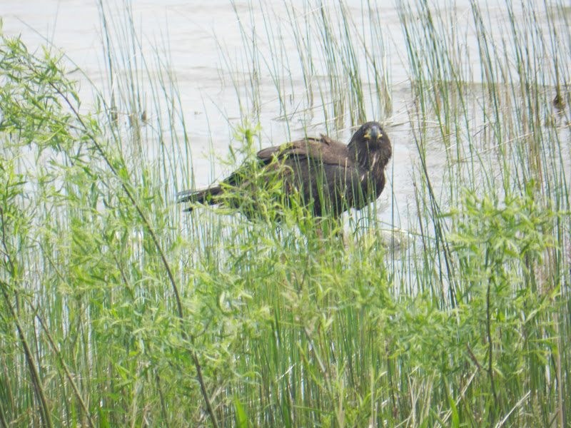
This noon, while eating lunch at our kitchen table, I looked out the window and watched an eagle doing the same, only with a dead fish, among the grasses near shore.  A seagull and a second eagle waited above to claim the leftovers.

It's never too late to get a good pair of binoculars and enjoy spotting these impressive birds.

-  Dick Purinton


Tuesday, June 5, 2012

DETROIT HARBOR AIDS TO NAVIGATION - contd.

Cylinder base for Detroit Harbor aid #5,  filled with rock to create mass.


Detroit Harbor, Washington Island -  

The second of two steel cylinders was transported to Washington Island Friday afternoon, June 1st, and was lowered over H-piles where buoy #5 had previously been tethered on chain and concrete sinker.  Roen crews began filling each cylinder with stone from their second work barge, and by late Monday, both #4 and #5 cylinders were ready for concrete.

A stationary mixer truck on deck was used to combine gravel, sand and cement, then the product was pumped into the cylinder. (photo below)

Concrete mixer (L) and crew ready to add to cylinder.
Below - Ferry Eyrarbakki shown outbound from the island dock,
alongside Roen's construction barge.


The bulkiness of these new harbor additions will be hard to overlook, even without their 20-foot or so tall light towers, yet to be added.

By Thursday, June 7th, if work on the two cylinder bases is completed, the Roen work barges and crew may depart this location in preparation for their next contract.  The final stage of light pedestal installation will follow later, after shipment of the units is received from the fabricator.

-  Dick Purinton