Showing posts with label Detroit Harbor. Show all posts

Thursday, October 24, 2019

MADONNA - CONSTRUCTION UPDATE 4.0


Inverted starboard aft deck corner shown, with Rich Ellefson standing against
a midbody bulkhead.  Square opening behind him will accommodate ladder
for access to the engine room.


Detroit Harbor, Washington Island -

Following one of our finer fall weekends of 2019, Saturday the 19th and Sunday the 20th, a strong weather pattern sat over the midwest and brought heavy rain, high winds in excess of 40 kts. from the south-southwest, and pounding seas.  Island docks and waterfronts, even in the generally well protected Detroit Harbor, were awash.   Sea action inside the confines of the Northport Harbor break walls made landing increasingly difficult Monday, with ferries surging hard against the mooring tires.  By 1:00 p.m., the decision was made to lay up until the following day.  The Robert Noble crew made its last run into Gills Rock, seeking better conditions for unloading.


Depth of hull at midships can be seen here
as workers fit and weld bulkheads.
Typical beveled flatbar awaiting fillet weld.


But, inside the snug confines of Fincantieri Bay Shipbuilding's fabrication shed, construction continued without a hitch.  Photos shown here were taken by Hoyt Purinton on Wednesday morning, October 23, with the shape of the new vessel now more readily seen.  - Dick Purinton

Monday, January 21, 2019

Start New Year on right foot

Start New Year on right foot


We're well into January of 2019.    

Ice fishing shanties are out on the harbor.  Four-wheelers, or walking are the preferred methods of accessing the ice at this point.  It may be a few more days before pickup trucks and their drivers venture from shore.

It's been one year and a few months since my last entry, I realize, and with such a lapse there may be no one who reads this or cares to get started as a follower once again.   But, barring unforeseen incidents, I shall in the future continue to grind out some light news from our home on Detroit Harbor.

In August of 2017, I had just announced my new book, Island Stavkirke - Washington Island's Norwegian replica.   Initial, local sales went over pretty well, as I had hoped when I ordered (and then stored in our basement) over 2,000 copies from the printer.  These things take time to catch on, I remind myself.  Lacking backing for marketing, because I self-publish, I depend on word of mouth and my own limitations in contacts.


Well, here's a cover from my most recent book, entries compiled while I worked on the Stavkirke book and received from the printer this recent mid-December.

Words on Water II - Island Journal 2017. 

Because I received this publication at a time when the Christmas season was upon us, several copies were then sold as gifts.  A few more were sold via my website, www.Richardpurinton.com.  All sales at this time of year are appreciated, because book sales remain light until weather warms and tourism returns.  

I've had the distinction, and perhaps an added sales push, of having my title "Words on Water," which appeared on my ferry journal book of 2007, chosen to describe two separate, local literary events.

Last September, the sixth Washington Island Literary Festival borrowed the theme "Words on Water," having first asked my approval.  Unfortunately my new book, Words on Water II, wasn't yet ready, and potential readers came away disappointed.
  
In another few weeks, on Saturday, Feb. 2, Groundhog Day, a poetry and musical event guided by Write On! Door County is scheduled for the Door County Auditorium.  It will also be titled, "Words on Water."  All poems submitted to a selection panel were to have water as a main poem theme.  How my title came to be chosen, again, I'm not sure.  I first read about this event in a Peninsula Pulse notice in December.  

Just to be clear (for readers who might be confused), I didn't take my most recent book title from either of these events!  

If you enjoy reading about local, Island happenings, or learning how events beyond our shores might have local impact, then this newest book, based on my 2017 journal, might provide you with insights, connections, and just maybe, a bit of humor.  Lots of images, too, both in color and B & W, over 50 all told.  

A major inspiration in writing these blogs is to start with a photograph.  That usually gets me off-and-running, and excited to put the topic at hand into words.  Today, I began without such benefit - other than the book cover - because I've not taken as many photos of late.  Maybe in the future I'll come up with a historic photo or two, something that "relates and resonates."  

In the meantime, I'll state that Mary Jo and I plan to remain in place this winter in our Detroit Harbor home, imagining what it might be like to be elsewhere.  

I have several writing project ideas, still in the wings, to keep me busy, and also several wood carving projects. Some are intended for the Stavkirke, others are just for the fun of it.
   
It's good to be back after such an absence, and I must say, getting back wasn't easy.  I had to ask a friend for technical advice in how to get recognized by Google, in order to access the administrative side of this blog.  My old password was no longer recognized, for some reason, and it took a bit of sleuthing, trial and error, to figure it out the right combination.

With my absence from writing and posting a blog, I've had to re-learn the tricks in getting a blog into shape for posting, all in a rather reasonable time frame.

Here's to another winter and the beginning of a new year, along with resolve to continue the posting of these blogs.
  -  Dick Purinton


Wednesday, March 4, 2015

ISLAND WATERFRONT - Then and Now - Part IX

Another photo from the Herschberger family album from the 1920s.
A crowd is assembled on Gislason dock in Jensenville,
presumably to greet passengers arriving by ferry.
Do you recognize anyone?
 
Washington Island, Wisconsin -

Before moving on to new territory, I need to make a few additions and corrections.

Thanks to additional information from Ann Young we have more names to add for the photo below, taken by a member of the Herschberger family.  (Most negatives are still in the family's possession, according to Ann.)

More identifications:  Besides Gordon Jepson in pilot house window (son of ferry
owner William Jepson),  from left are:   Charles "Buzz" Gislason, brother
Gene Gislason, unknown man, Ruth Herschberger, Harriet
(Herschberger) Platzman, and unknown lady.
Charles and Gene were sons of Ruth and Lawrence Gislason.   Charles was named, we suppose, for the brother of Lawrence who died and received posthumously the Croix de Guerre from the French government for losing his life in WWI.   The Island's Gislason-Richter American Legion Post 402 was named  in Charles' memory.  (Ludlow Richter was killed in WWII.)

Gene had an illustrious career in the U. S. Coast Guard, and he was decorated for bravery in landing craft operations at Normandy.  He retired with the rank of Captain.  One of Gene's retirement projects was to tabulate information about as many Washington Island working craft as possible.   His tablet of information was edited, and added to, by Hannes Anderson, himself a retired U. S. Navy Captain.

Do you remember the photo of an early ferry or island freighter under sail?  (See the Feb. 17th posting for a photo)    The name on the bow is too small to be read.  Ann Young thought it might be the Wisconsin, but there were a number of small freighters that had a similar look, and most of them had curved lifeboat davits mounted on the wheelhouse.   From Eric Bonow came the suggestion it might be the Marion, also used for a brief time period as a ferry.  He offered the photo below as a comparison, noting the rather "blocky" aft house that was partially enclosed by a weather curtain (which the vessel in the other photo also displays).  In this photo, too, a steadying sail is bent on, ready to be hoisted when away from port and on course with fair winds.   I give the nod to the Marion.

Marion at unidentified pier, year unknown.  


Anyway, this is another interesting photo.   In the foreground, is that a float for working on vessels, or an early channel marker of some sort?  And speaking of channel markers, what is that float with raised structure in our top photo, tucked behind the Gislason pier?   Could it also be a private channel marker set out by the ferry operator or commercial fishermen?

Finally, in a correction, I must withdraw my comments regarding the Goodrich Steamer photo having been submitted in Fred Richter's application for the Elbow Light.  It was not a part of his application. (See blog posted March 3rd)  An error by someone else in combining the two was then compounded by my wrong assumption.  However, I'll stand by my statement that no vessel of that size (length and draft) ever fit itself into Detroit Harbor!

I think we've cleared the decks now and can steam ahead into future blogs.  But keep the comments coming - and photos, if you have any.   Google makes it hard to respond to these blogs, but I also receive occasional comments by private email.  Let me know if its OK to reprint them in the comment section.   I'm not comfortable in reprinting them or using your name without your permission.

-  Dick Purinton

ISLAND WATERFRONT - Then and Now - Part VIII

Judge Herbert, from Chicago, owned a boathouse (and perhaps a rudimentary
cabin) where Tim and Lois Jessen live today, in the community near the old
Gislason Store known as Jensenville.   The Herschbergers lived nearby.


Washington Island, Wisconsin -

A most welcomed occurrence resulted from an earlier blog on early Island ferry service.

Ann (Herschberger) Young has been going through a family album, and she passed along photo gems of the past.

Most important is that through this album we can learn more about the people in earlier photos I've used, the vessel ownerships, general waterfront relationships of the 1920s.  Questions raised from earlier photos are answered in part with the Herschberger photos, family members who, according to Ann, enjoyed photography and took the time to add captions and names to the photos.


The topmost photo tells us who owned the Caroline, a distinctive boat built by a man named Amundson in Jackson Harbor (who I believe lived on the property later owned by the Lindgrens).  The Caroline was a Herschberger boat, and we see C. B. Herschberger on board in one photo, and a group of men in another.

Profile of Caroline with family / guests on board in pleasant weather.


C. B. Herschberger was grandfather to Ann, John and Bob.  His son, C. B. Jr., was nicknamed "Bunny," who with his wife, Anita, owned a cabin on the far southern tip of Detroit Island.  (The cabin was built by Anita and her first husband named Wilson, according to Ann.)  Later on, this property passed on to his son, Bill, and then more recently, through his estate to his children, who still own that property today.

Arrow points out George Tobey Sr.
Gislason store is noted.


The following photo series tells us more about the Caroline and how she foundered during a run in rough weather for medicine.   She was later "abandoned," using the parlance of vessel undertakers.      Accordingly, C. B.'s hand-written notes made on the vessel's letter of registry indicate that government notification was made.

Caption to the drama shown above when the Coast
Guard takes Caroline in tow:
"1923 - Caroline sinking - plank sprung out at Sister Bay (?) -
Gale N. W. -  Trip made for scarlet fever serum - Boat just made
Lobdells Point"


With thanks and appreciation for the photos and information...

- Dick Purinton

Tuesday, March 3, 2015

ISLAND WATERFRONT - Part VII - Elbow Light

Arrow points to a vertical timber lifted by ice, its lower end
still embedded in the base of stones.  This aid marked the old
channel into Detroit Harbor.  Many years, during average
water levels, both this timber and the rock pile
supporting it lay just beneath the surface.  The modern-day
aid (#8) is a steel nun chained to a cement anchor
and maintained by the U. S.  Coast Guard.


Washington Island, Wisconsin -

Over the weekend of Feb. 21 we drove around the upper part of Lake Michigan to visit son Thor.  It was his 35th birthday.   If he thought those 35 years went by quickly, it was like lightning for us.

Passing through Green Bay, I took the opportunity to have my three month check-up on the titanium implants in my knees.   I received confirmation that the occasional clicking sensation in my new joints - something that concerned me - was simply the clatter of plastic inserts glued to the underside of each patella.  It wasn't quite the same as sloppy clearances on valve tappets, I was told, and I shouldn't worry as it's quite a normal function of artificial knees.

We looked forward to our winter's trip from the Island, and the further north we drove into the UP, the snow showed greater accumulation, more in keeping with expected ground cover for late February than our skimpy Island snow cover.   A major portion of the highway vehicle traffic we saw, especially as we drew closer to the Straits, consisted of 4-wheel drive vehicles pulling snowmobile trailers, dozens and dozens of them.

Between card games and snacks at our comfortable hotel in Petosky, we sandwiched in a couple of visits to the Van Dam shop in Boyne City to observe progress on their latest boat building projects.  Friday afternoon I met several of the craftsmen who were still working, winding up the last half-hour of their day and their workweek before they put tools away, swept up and departed for the weekend.

For someone who enjoys this specialized boat construction process, there's a lot to take in at the Van Dam shop.


The hull of a sandbagger, a uniquely developed
 Chesapeake Bay sailboat design, takes shape
quickly as the first longitudinal strips are added.
Here, at the end of the day, Thor scrapes
excess epoxy oozing from joints of
recently attached strips.   Beamy, bow-on view
with low freeboard resembles a Viking
longboat.
Strips of cedar, about one inch in thickness, provide the first
layer in this sailboat's hull.   Two more layers of 1/8"thick
mahogany strips, laid on a 45-degree bias,
will follow, also held in place with epoxy.  Due to
hull curvature, stainless screws and washers
 are used to secure strips until the
epoxy dries, after which time they'll be removed.

So far, this blog departs from the subject of my previous several blog entries, but doing so allows me to get underway slowly by inserting a few loosely related comments and photos, before spinning off into a continuation of Island waterfront history.

From the ferry's deck the morning we left, against the low sunlight I noticed a timber projecting upward from the old stone pile, the remains of the original channel marker.  During these past two months this same timber has risen between 3-4 feet, forced upward by the grip of ice and the rise in harbor water levels brought on by strong southerly winds.

My photo (at top) shows what nearly every winter traveler sees from the Arni J. Richter as the ferry departs from the Island dock and makes its turn southward down the channel and on toward Northport.  I highlighted the old timber with a hand-drawn circle and arrow.  The modern day red nun marking the east side of the dredged channel is frozen in the foreground ice.   You may recall I pointed out the old channel marker in my Jan. 31 blog, noted in a photo in which Dora Engelson stood before the ferry Welcome with several children in tow, taken sometime in the early 1940s.   As a novice, I learned from Captain Nathan Gunnlaugsson that this pile of stones with a timber protruding from it marked the "false channel."  It had been worn down so by ice movement and waves that most years it lay in waiting beneath the surface to snag unsuspecting boaters.  This "false channel" was the original, or natural, channel denoting acceptable depths, and it was used for many years by vessels entering Detroit Harbor proper.

The forces that are brought about by the hydraulic lift of the lake, following hard freezing around an object, has destroyed many a massive crib of timbers filled with stones.   We can see evidence along the island shoreline today of old fishing docks, torn apart even when considerable efforts were made by the pier owners to repair them.  Eventually, most crib docks and timbers were leveled, some in only a few years' time.   So, it comes as no surprise that a single timber remaining upright from an old navigational mark should be lifted by the ice, too.  What does amazes me is that this process took so many decades, including years when the stub projected above the lake level.  This winter, mother nature managed to extract this timber.

What is the history of this particular stone pile with timber?  Eric Bonow sent along some interesting information about the origin of this navigational marker, officially referred to as "The Elbow Light" (likely it referred to the dog-leg course change leading mariners into Detroit Harbor from the West Channel).   The photos and documents provided by Eric are courtesy of the Washington Island Archives.

At far left, the "Elbow" marker when it was in good shape (year unknown).  
 An unidentified small sloop heads into the harbor, its crew 
bundled in jackets and caps.  In the background on "Richter's Point,"  
Detroit Island, are buildings of the old fishing camp.

Fred Richter's application for a fixed red light was
made July 31, 1924, at a time when small freighters,
commercial fishing vessels, and relatively recent
auto & passenger ferries entered Detroit Harbor
with frequency.  The photo of a Goodrich steamer was
included with his application as an example of area maritime
trade, but it is unlikely this steamer (or any of similar
size) ever navigated to or from Detroit Harbor.


Fred Richter was one of nine children of Jacob and Anna Marie (Kalmbach) Richter.  He fished, along with his wife, Ida (Cornell), and they at one time owned the Pearl, a  boat named after their daughter.  (Two sons were Roy and Earl.)  The Pearl, according to a record of vessels compiled by CAPT Gene Gislason, was just under 30-ft. in length, and had been built by Nels Jepson in Detroit Harbor in 1906.


In the official Great Lakes light list, published some time after the light was installed, the aid's characteristics were as follows:

Fixed red, in 7 feet, on east side of north end of channel, at turn.

The light was affixed ten feet above high water, atop an "unpainted pile."

Under Light List "Remarks":
      Maintained by Mrs. Fred Richter, Detroit Harbor, Wis.

Anyone who has been boating at night in this harbor without the benefit of radar, GPS or depth finder knows how hard it can be to differentiate land formations from good water.   Although the gas buoy was in place at this time, located seaward from the entrance to the West Channel, we can assume the addition of this Elbow Light was welcomed enthusiastically by mariners for both nighttime and daytime navigation.

-  Dick Purinton

Wednesday, February 11, 2015

ISLAND WATERFRONT - Then and Now - Part IV


Washington Island -

Continuing the theme of looking at the Washington Island waterfront as time changed, I've come across photos that interest me, and I hope readers who have a connection to Washington Island are similarly interested.

My personal knowledge, and the photos readily available to me help me to make connections.  Most of these photos center on Detroit Harbor, but there are occasional, interesting side trips to other harbors and piers.   I'll admit these are not placed in a chronological sequence.  Rather, I've followed what piques my interest, and also what pops up that seems to make a connected story or sub-theme.

The photo above, for instance, is a fairly recent one.  I've received aerial photos over the years from pilots (Jack Cornell, Tim Graul and Ed Graf, to name a few) but I believe I took this one seated in the rear seat of an ultralight, behind pilot Butch Gordon, in February 1990.  (If anyone believes I'm wrong, please let me know!)

I was interested in obtaining photos for the book Over and Back (published later that summer), and Butch offered to take me up in his small plane one late afternoon when the sun's angle was low in the sky.  At the island ferry dock as shown above are five ferries, with the C. G. Richter moored on the end of the pier, and the Voyageur moored at the Standard Oil dock's north side.  (Both of those ferries were sold years later.)  At this time, all Hansen Oil product tanks were still in place, and you can see autos parked south of the tanks, in the general area that is now open pavement leading to the new ferry terminal entrance (completed in1996).  The old ferry office on the dock was still painted white, later to become "federal blue."

Eric Bonow,  from Superior, Wisconsin, who enjoys digging into history, especially anything to do with regional maritime activity, visited last week.  In our conversation Eric reminded me how as operators we had to avoid a shoal area located directly astern of where the C. G. Richter is moored.  This shoal wasn't dredged until around the year 2000.   To safely leave the channel and head in to the pier, we used a range consisting of the light pole in line with the old office door.   Then we were assured of staying in deep enough water.  This shallow hump (with about 6-8 feet of water over it) also had to be avoided during ice breaking around the docks -  just one more deterrent that, when eventually removed, was longer thought about.

The relationship of the current ferry dock to the adjacent Standard Oil pier, and to the Island Outpost dock north of that, is clearly shown in this photo, and that's the main reason why I chose to feature it here.

Below is a May 1930 survey of the ferry dock property (the earliest survey I've seen), courtesy of Eric's sleuthing at the Courthouse.   I believe this survey was produced because of an impending sale of land from  Ole Christiansen to Captain William Jepson, who before that sale operated his ferries from the far eastern side of Detroit Harbor.   Ole's marine railway is indicated in the survey.

May 1930 survey of Standard Oil (previously the Cornell Tract)
and Ole Christiansen tracts  (later Wm. Jepson's, then WIFL)
in Detroit Harbor.


In a previous blog, I wrote that Ole was co-owner of a pier in Jackson Harbor, along with Bo Anderson, and a chart and photos Eric passed along show where that pier was located.  The photo is an old postcard, and although its not entirely clear in this version, piled lumber can be seen on shore and an unidentified small sailing vessel is at the pier, presumably loading - year unknown.

Related text reprints from the Advocate newspaper follow:

 Door County Advocate - 2.28.1903:
   The bulk of the Forster Lumber Co. lands have been sold mostly to settlers, the heaviest investors being Bo L. Anderson and Capt. Ole Christianson (sp), who secured about 500 acres.  These gentlemen are now engaged in building a dock inside the east point near the entrance to Jackson Harbor.  The cribs have all been completed and the stringers are now being laid.  There are two gangways to the main structure, which will prevent all backing or turning by teams.  Three vessels will be able to lay at the dock at the same time.  Captain Christianson is superintending the work which is a full guarantee that the structure will be put up in good shape.   The entrance to Jackson Harbor is shallow, so that only light going craft are able to pass in our out.  The owners contemplate removing the bar, which is only a few yards wide. They will likely have a small dredge do this work, although Captain Christianson has told us that he could remove the bar by other means, but at all events it will require a good outlay, but when this obstruction is away, allowing large vessels to load at the dock, it will fully pay for the outlay.  Besides that several of those owning timber lands on the northeast side have expressed their willingness to help pay for the expense in deepening the inlet. The enterprise of Messrs. A & C is sure to have the effect to build up Jackson Harbor.  There are thousands of cords of wood to go over the dock, and shipping is bound to be lively for some time to come.


Jackson Harbor shown on 1922 Lake Survey
Chart.  (Courtesy of Eric Bonow)


Door County Advocate - 7.30.1904:
Capt. Ole Cristianson is and has been engaged in the wood trade between Jackson Harbor and Milwaukee with the schooner Madonna. The Lucy Graham, Capt. Goodletson, is also carrying fuel from the same place to Manitowoc.  She came here on Saturday night for the sixth time so far this year.  The crew report that the yards are filling up rapidly, and the delivery will have to stop soon until more room can be secured.  Although 36 years old the Lucy is as sound as a trivet, having been well taken care of by her owner.  She was built at Sturgeon Bay in the winter of 1868 by the late Capt. Robert Graham, one of the pioneer residents of the county.

Door County Advocate - 12.3.1904:
The portable sawmill for Christianson & Anderson has arrived, and is now being set up.  The firm has enough orders ahead to keep the outfit busy the greater part of the winter.  Strange to say the demand all comes from the islanders, who are rather adverse to sawing their stove wood by the old and laborious method when it can be done by steam in one fraction of the time.  The buck saw is a thing of the past.

Door County Advocate - 3.4.1905
A good deal of cordwood is being banked every working day at Jackson Harbor, and the owners anticipate god prices again for this commodity.  There are two piers over which the wood will be shipped, that of Anderson & Christianson and Ras. Hansen.  The latter, which formerly belonged to Capt. Denio, is undergoing a substantial rebuild this season.

Door County Advocate - 10.10.1907
Rasmus Hansen is steadily improving and developing his Jackson Harbor property which has in late years become one of the most important shipping points in this region. 
The Lucy Graham has been lying at Jackson Harbor for more than a week waiting for a load.  Capt. Goodletson says that wood is getting very scarce in these parts, but he hopes to get in a few more trips before the end of the season.
  Chas. Anderson, Matt Swenson and Ben Jensen are building a structure on the south side of Jackson Harbor to be used for a saw mill, and as soon as it shall be completed the outfit will be removed to that place from the west side of the pond.  Business is pretty lively at that point, as there is considerable wood being banked and carried to market by the schooner Madonna, Capt. Ole Christianson.


Postcard - Jackson Harbor, inside Carlins Point, early 1900s.


After nine more years, the shipment of timber had slowed…and it was around this time the Madonna was abandoned in Detroit Harbor west of Snake Island.   Ole Christianson may have concentrated his efforts from that point forward at his shipyard on Lobdell Point.

Door county Advocate - 4.6.1916:
The Jackson Harbor Mill Co. will begin their spring sawing this week. Lumbering is nearly a thing of the past on the Island, the stock of logs being comparatively small.  But, still we wonder where so many come from.

  - Dick Purinton


Saturday, January 24, 2015

ISLAND WATERFRONT - THEN & NOW - Part I

ISLAND WATERFRONT - THEN & NOW

- Washington Island, Wisconsin

After my last post and the photos that showed how piers in Detroit Harbor looked a few years ago, I decided it's a good time to go into more detail - as much as possible, that is.  A great deal of information has been lost, and as a result we use conjecture to reconstruct the way we thought things were.

This year will be the 75th for the Washington Island Ferry Line, hence the logo with the dates at the top.   If nothing else, this provides further excuse for delving into the past, something I always enjoy doing, especially when it involves old photos.  And in the case of Island harbor docks and activities, in many cased these photos seem to do more to tell the story than available written information.  So, I'll liberally illustrate the way things were in the harbors using photos available.   A few of these may look familiar.  Either I've already used them in earlier blogs, or they've appeared in Over and Back - A History of Washington Island Transportation (a book published in 1990, in timing with the Ferry Line's 50th Anniversary, and out of print since about 1997).


The pier photo shown in my previous posting was taken by Bob Williams in 1949 (related, I believe, to Dede Rollo, who had a cottage in Jensenville), and it showed the Chris Andersen freighter WISCONSIN, at the location we now know as the Island Outpost dock.  I believe that earlier this was the dock developed by J. W. Cornell, where he moored his fishing boats.

Because of the interest expressed, below are several more photos of the WISCONSIN during her earlier days of ferrying cars (most likely the mid-to-late 1920s).  The pier location at which she is loading, in my opinion, appears to be near the present day Shipyard Marina.  Perhaps the base of this pier was the former Gislason dock, used by the store's owners at the turn of the last century for receiving shipment of goods for their store.

This photo was taken of the J. W. Cornell family when four identical
autos were loaded aboard the WISCONSIN (maybe just arriving
at the island for the first time).  This photo also speaks of a
time when money was to be made in commercial fishing, as the
autos were purchased by sons of Clara and J.W. Cornell.  Sons

Claude and George are believed to be in the white hats, standing behind 
their parents.   They, and another son, Bill, we believe were the owners 
of new Hudsons.   Daughter Mary (Richter) is in the back row, 
right hand side, with dark hair, and her sister, Audrey, is in
front, blond hair, looking at the camera.  According to the Door County 
Advocate issue of June 24, 1927,  an article clipped by Eric Greenfeldt 
(grandson of Bill and Harriet Cornell):  " It is quite surprising how many
high priced autos have been sold on the Island recently.  George
Mann sold three Hudson cars in one day, which is suggestive
of the business being done in that line here."


This early photo showing folks dressed in
fashionable wear

speaks to an early tourism trade.
The end of this pier as shown is broad and smoothly decked-over, suitable for maneuvering and loading automobiles, passengers, or for stacking freight.  That was the location William Jepson, one of the early ferry operators, used until the very early 1930s, at which point he transferred landings to the present Lobdell Point ferry landing location.  Jepson purchased and then developed the boatyard property formerly owned and managed by Ole Christiansen.

Shown is the early beginnings of the ferry dock at Lobdell
Point.  Logs piled on ice show work is in progress.
A small shack in the background is on the
Standard Oil pier, where barrels can be
seen lined up along that pier.  Bill Jepson, who was

responsible for this dock work,
was an avid photographer, and so it is likely
this photo, as well as many other early 

ferry photos, were taken by him.
Ole's name popped up a number of times when I researched the Thordarson book.  At one time Ole had a pier in Jackson Harbor for the purpose of loading timber products.   I'm just guessing, but I think his pier may have been located in the fairly deep water tucked inside the northeast corner of that harbor (the remains of old cribs can still be seen there along the shore).  Ole, who was quite enterprising, also owned - and was the last owner  of - the schooner MADONNA.   In later years (about 1915 or so) this vessel was grounded and abandoned in Detroit Harbor, in the area immediately west of the old Ida Bo (or Holiday Inn) pier.   Bits and pieces of the MADONNA still are mired in the bottom in that general location.

Summer fun with a rowboat, taken in front of
the cottage currently occupied by
Connie Essig.  MADONNA remains are
in the background.
A photograph from old Koken photos show children (perhaps Koken grandchildren?) playing in a rowboat, with the remains of the Madonna visible in the background.   For general interest, I've included here another Koken photo, one of their motor launch BERYLUNE, shown loaded to the scuppers with cedar shakes.  Where those shakes came from is anyone's guess, but very likely they were transported to the island by ferry to the shipyard location, and then reloaded by the Kokens for transport across the harbor to … the bayou estuary, where the Kokens owned what became later on the Arni and Mary Richter property.  The Kokens had a small pier and, later, a boathouse with marine railway.   Many of the buildings on this piece of property were - and still are - sided with cedar shakes.


BERYLUNE is a fine little boat with classy lines, and if you'd like to see her in a beautifully restored condition, please visit the Gills Rock Maritime Museum where she's a featured display, complete with her 1-cyl. Straubel engine.  How this craft wound up in the Gills Rock museum, and what the trail of ownership might have been after the Kokens owned it would be a good research project.  (Perhaps a reader may know the answer?)

BERYLUNE at Bayou dock in Detroit Harbor,
loaded with bundles of cedar shakes. (photo
taken perhaps late 'teens or early 1920s)
But, back to the early ferry WISCONSIN, a wooden vessel pressed into service as an auto / passenger ferry back when only freight boats were available for such trade.   We can see that loading was no picnic, but with the use of planks three or four autos could be squeezed side-by-side, thwartships (or rail-to-rail, rather than fore and aft).   This worked for a number of years, with several different in service.

Next time I'll use information from early county newspaper accounts that detailed the efforts of several operators to start an island ferry service, sent to me by Eric Greenfeldt.

-  Dick Purinton

Thursday, January 22, 2015

WINTER DOCK WORK

Detroit Harbor scene.  In foreground, the Standard Oil pier,
later Hansen Oil, and as of late 2014, Ferry Line north dock
Behind that is the former Cornell dock, now Island Outpost,
with Chris Andersen and his freight boat Wisconsin.
(photo taken in 1949 by Bob Williams)
In the background are several abandoned vessels in the shallows,
near what was the Chambers dock, now  the location of the Town's
launch ramps and the Island Clipper pier.


- Washington Island, Wisconsin

Like many waterfronts, Detroit Harbor changed over time, but many of those same appendages that were fishing or freight piers years ago remain in place, raised up and shored up over time as better materials and construction techniques, and capital to make improvements became available.

The dock in the foreground was owned at one time by Standard Oil.  It looks quite trim, capped with concrete, and it was used as a platform for unloading barrels of petroleum products, as well as transfer and other freight from the Anderson Transit's American Girl and barge Oil Queen.  (The Island Electric Co-op, with diesels placed into service in 1946, was using several hundred thousand gallons of diesel annually, and the Oil Queen helped to fill the tanks that kept those engines working.)

In the 1960s a good portion of the Standard Oil pier was enclosed with steel, with sheets driven outside the existing timber cribs.

Over time, the timbers that made up the old pier deteriorated, and so have the steel tie-backs and whaler supports that hold the sheets from tipping outward shown significant corrosion.  Much of the pier's interior wooden cribs and steel tie backs will need removal, or replacing, in a shoring up process designed to strengthen the dock before new fill and a concrete cap are added.

Detroit Harbor is frozen solid, and has been for the past
several weeks.   Here, Rich Ellefson and Joel Gunnlaugsson
are shown on the pier.   Several openings were made along
the pier face for examination of existing
dock structure.


Steel arrived Monday by semi, and work is now underway, much of it undertaken by ferry crew as a winter project.  So far, they've been favored with mild and sunny January weather.   Tom Jordan, Island contractor, has some of his equipment on site to help break up the old concrete cap into smaller pieces, eventually to be trucked away.  Mike Kahr of Death's Door Marine will bring a larger machine later today, for driving sheets into the bottom.   This is an ideal time of year to get this sort of work done, as all of it can be done from the existing pier structure - and of course, there are few, if any, onlookers to get underfoot.

Con McDonald (L) and Tully Ellefson
cut steel for new dock brackets to support
tire fenders.      
With mild weather and relatively modest winds, recent ferry crossings have been excellent.

Other than a few fishermen on weekends, traffic is made up primarily of service providers, suppliers and Islanders who need to travel back and forth.

-  Dick Purinton


Saturday, September 13, 2014

SHIFTS IN THE WEATHER

Dark clouds, distinctive rays and backlit vegetation
made for an interesting sunset at the Bayou the
day before our weather became stormy.
Detroit Harbor, Washington Island -

Maybe I've waited too long to publish these photos, because the weather has been in continual flux since they were taken.

First, we experienced warm and humid weather in the high 70 degrees (high 80s in much of the midwest) leading to violent storms and great rainfall amounts. Then starting with Thursday, Sep. 3rd, flooding occurred in areas where flooding is rarely seen, towns such as Baileys Harbor.   Trees were downed, and creeks, rivers and swamps were filled with runoff.  

Dramatic squall line between powerful rain cells
as the stormy mass moved across Detroit
Harbor in the early afternoon. The low pressure
remained to our west and moisture then circulated
from east to west over northern Lake Michigan.   
At our home we experienced power interruptions, frequent during the height of the storm, but never for more than about 20 minutes.   The REA crew stayed on top of downed trees to keep power supplied locally, but the Peninsula experienced wider and longer outages, some for close to 24 hours.

We were in Karly's for a hamburger before the first wave of the storm hit, taking in with us a slicker just in case, because the radar showed a massive storm cell was headed our way.   I had begun working on my french fries when the power went out. The deluge intensified outside, with heavy, tropical-like rains at times.

This pattern continued throughout the night of Sep 3, on and off.  As one large cell passed over, or split and went north and south, another just as large and intense formed inland to the west, taking its place in the sequence.  Around 8:30 pm, with island power temporarily out and an intense squall in progress, Hoyt and Rich were called on to make a special medical emergency trip.  

The Packer game in Seattle that same night wasn't impacted by Wisconsin's weather, but our TV viewing was.  Frequent, but brief, outages had us listening to part of the game on a battery operated radio.  It was a good diversion from a game that in many ways echoed the night's weather:  a relentless pounding.

Patrons supped contentedly at Karly's, unfazed by the
power outage, as heavy rain fell outdoors. Tim stated
the power would be back in 20 minutes - and it was.
This moist air mass began well to the southwest, Oklahoma and Nebraska, through Iowa into Minnesota, Wisconsin and Michigan.  Rather than this large humid air mass being pushed briskly to the east by a cold, high pressure air mass, which is often the case, the winds remained southerly, and we enjoyed a few more days of pleasant, warm summer weather before the pattern seemed to repeat itself.

One week later, Sep. 10, stormy skies reappeared, this time with less rain but more wind - gusts in the 40+ mph range for ten hours or so.  When the cloud cover finally eased a day or two later, we found ourselves in a high pressure system with fall-like temperatures: mid-40s by night, daytime highs in the lower to mid-50s.  

This change provided a good reason to get the pellet stove going and shut down basement humidifiers.  The drying warmth felt good, both the real heat and the psychological warmth a fall fire can bring.

Photo taken by wimpy photographer aboard the Robert Noble.
 I rolled down the window for this one as we headed through the break wall
and into the NW gale.  Temperatures dropped 10 degrees in one hour,
and winds picked up dramatically in late afternoon,
Wednesday, Sep. 10, but all ferry trips were completed.

Yes, fall is firmly in place.  The bow hunt for deer season begins today, and I believe we heard blasts from a goose (or turkey) hunter early this morning.  Several maples now show signs of bright colors, and our fields suddenly seem to have lost their summer green.  Plants are in the latter stages of production.  High bush cranberries are turning a bright red.  

Many great days lie ahead, however, and it's a time of year that many of us prefer to any other: sweater weather.   Still pleasant enough for just about any outdoor activity of your choice, at least during the middle part of the day.

Time to get out and enjoy it!  -  Dick Purinton

Friday, May 16, 2014

SQUADRON MOORS IN DETROIT HARBOR GRASSES

Photo taken 8 a.m. Friday morning in Detroit Harbor.
Detroit Harbor, Washington Island -

Resting from their maneuvers for a brief time, a squadron of five white pelicans joined two great blue herons and two great egrets (at left) in the grassy shoreline of Detroit Harbor this morning.   We've seen pelicans paddling about offshore and on the wing, but not resting and preening on shore as they did this morning.  The warmth of the rising sun, coupled with the morning's cold air - 38 degrees - may have encouraged them to come ashore.

Since before ice departed at April's end - not all that long ago - we began seeing these birds in the harbor, but they never posed together for a photo as they did this morning.  Old timers would have choked on their Plow Boy chew if someone claimed to have seen a pelican or an egret on Washington Island, but these birds have been as regular as robins in recent years.

A few days ago, word and photo were passed along that Randy Holm, Rock Island Park Manager, spotted a tropical crested caracara near his home.   Apparently, it was feasting on a raccoon carcass.  Melody Walsh surmises it might have flown north with turkey buzzards.  

A number of passengers seen onboard the ferries recently with binocs dangling from their necks and notebooks at the ready would indicate there will be interest from the Wisconsin birding community.  If this bird fancies raccoon, a common enough roadside mammal, perhaps we'll see more of it in the coming days.

We find it almost impossible to believe, but bob-o-links that nest in this same field on Michigan Road near where Randy spotted the caracara are believed to fly all the way from way south in South America (Argentina) to lay their eggs here.  Quite an undertaking.

Such sighting information may serve as a good reminder to birders that the Island Bird Festival isn't far away, the weekend of May 31/June 1.     The banquet registration deadline is today, May 16.  For registration and general festival information go to:     www.islandbirdfest.org  

-   Dick Purinton


Sunday, April 6, 2014

SPRING STUTTER-STEPS


Ice several feet thick had to be broken by machine in order
to open the approach to the Potato Dock Saturday afternoon.

Washington Island, Wisconsin -

It's not over yet, Old Man Winter, and we were reminded of that fact Friday, with 4-5 inches of heavy, wet snow.  We saw a brief let-up around noon, then snowfall resumed, even harder, in the late afternoon.  Large disks of lake effect snow were whipped by high winds.

Those winds, which strengthened and backed toward the north, were enough to stream heavy ice through the Door Passage into the lake.   This, coupled with hampered visibility for what was in the ferry's route,  brought cancellation of the first Friday evening trip of 2014.  By Saturday morning the snow had ended, and the sky was sparkling clear - and ground cover sparkled, too.    Fresh snow stuck in the trees, and the air temperature was at 23 degrees at 7 a.m.

With a few passes of the shovel, clear patches here and there, the rest was left to intense sunshine.   Most of our snow was gone or on its way out by late afternoon.

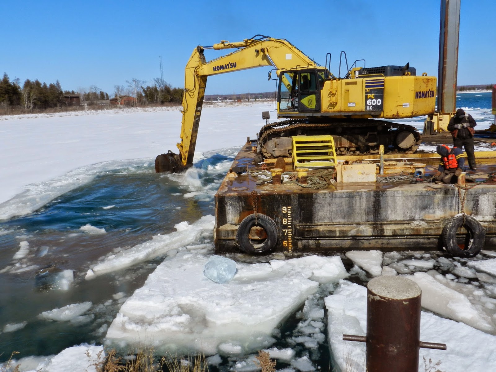
The Roen crew had arrived at the end of the week to get their equipment running.  Saturday morning their tug was operational and the crew broke out their crane barge.  By Saturday afternoon they were engaged in opening up the area next to the Potato Dock, so that dredging can begin soon and scows of spoils can be pushed alongside that pier for offloading.  The channel dredging project should move forward this week if ice and wind don't interfere with the maneuvering of the scows or with the rather delicate silt curtain, a requirement while when digging takes place.  (As of Sunday afternoon, the northern half of the channel in Detroit Harbor had broken ice, floated in and held by southerly wind.)

School Navigators Unit is a success

One point I want to relate was the great success Washington Island Schools Navigators unit.   The unit began, if you'll recall, with a trip aboard the Arni J. Richter on St. Patrick's day, March 17.

This Friday afternoon, with their work completed, students and staff hosted an Open House for the community at Washington Island School.  All ages and all grade levels participated in this project.  Clearly, each class put in a great deal of work and thought on this project.  I was impressed with the quality of their end-product, and the enthusiasm the students showed for their work, which was designed to help them learn more about their community, past and present, and learn new skills in the process.

In the 4-6 grade room, Ryan, Max and Aidan showed Mary Jo and I around their computer website, after ensuring we were property greeted, then comfortably seated, to observe their product.  Mary Jo was one of several Islanders interviewed as a former student of the old Detroit Harbor School, but there were many interviews done by the students.  They set up the interview appointments and asked the questions, and took notes, and later wrote up their notes, which can be seen on their website, along with photos.

Elementary school children listen to early
Islanders' stories onboard the Arni J. Richter.
Students, even the lower grades, became adept
interviewers, researchers and historians during the
following weeks.
You can learn about their Navigator unit, too.  Go to the school's website, and from there you'll find pages for each grade levels.   Given a close look you'll see the results of their many hours of interviews, research, and discussion.  It's a masterful job by both staff and students, and should itself be entered into the Island Archives.

Here is the web address:      www.island.k12.wi.us        click on:  WINS Spring 2014 Voyage

Birds and such

Aside from the fresh snow, the first thing I noticed Saturday morning when I looked out the window toward the harbor was a large bird with the appearance and size of a hawk struggling to subdue a duck.  This struggle took place about 15 feet from the edge of a small opening in the ice where springs keep the ice from freezing.   According to fresh tracks in the snow the larger bird and duck had already dragged about 20 feet.   The duck, using all of its remaining strength, was scooting the pair toward the opening's edge.

I was too excited at this point to grab a pair of binoculars or my camera as the drama unfolded.  I expressed an inner "Yes!" when the duck maneuvered itself into the water, large bird still firmly attached.  If it can make it to the pond, I thought, the larger bird might let go.  But, with equal grit and determination, and superior strength, the hawk-like bird pulled the duck back onto the ice.  Once on its back, the duck's feet went skyward in classical, almost cartoonish style, and they ceased to kick.

With a fleeting chance for a good Falcon photo,
my camera was set on autofocus.  As a result the foreground
branches are sharp while the bird is out of focus.
Within seconds (and this whole scene unfolded in less than two minutes) the large bird took off with its prey to one of the trees east of our home, out of sight.  This bird had a meal, and I suppose I should add deservedly so, given the work put in.

In about half an hour this same bird appeared again and roosted in a branch above spring opening.  There on the branch it preened and spread its feathers, drying them (I guessed) from the quick dip in the pond.  After 20 minutes it moved from that perch to another tree on the far side of the opening, and it resumed its preening.

Now I could see more clearly through binoculars, and I took a few photos (they turned out quite blurry, sorry). Mary Jo and I are quite certain it was a Peregrine Falcon.  (If bird experts out there differ in this opinion, please let us know.)

About an hour later, a young eagle was seen circling over the same small pond, swooping low, also looking for a duck dinner.

In the last 10 days we've seen the arrival of geese and sandhill cranes, pairs that would in past springs be swimming close to Snake Island or the old, partially submerged Ida Bo dock, or walking the shoreline looking for food.  The sandhill crane pair walked past our home on the ice during Friday afternoon's storm when snowfall was heaviest.  What they're finding to eat, with insects not yet out and ice covering the harbor, is hard to imagine.  The few openings in the ice that appear near shore, where springs keep the waters ice-free, become sought after holes for wading and swimming and finding food, maybe.

We're not the only ones anxious for warmer weather.

-  Dick Purinton

Tuesday, February 18, 2014

QUICK SET CHANGES

Green Bay Road, Monday morning, Feb. 18 - 8:15.
 Washington Island, Wisconsin -

If this top photo looks inviting - a pristine scene, fresh snow on the ground and frost on tree limbs - it certainly was.

Since returning home last Wednesday we've seen a range of weather, but none more changeable than the last 24 hours.   Generally, we've had consistently cold weather with highs of ten degrees or so for the day.  Snow has fallen every other day, it seems…then yesterday we had five inches (by my estimate), sometimes with blizzard conditions due to blowing snow in the 30+ mph gusts.

It was a great day to be indoors.  By later that evening, a nearly full moon had come out.  But in the early morning a fog bank crept in from the lake, hovering about 20 feet off the ground.  Six degrees, according to our thermometer, and very still.  A temperature inversion had apparently brought the fog. It was dramatic and quick, like those set changes on a stage between acts, where all of a sudden the lights come back on and the audience is transported yet again.  This foggy act was brief, and it departed along with the ferry by 8 am.

By that time, bright sun took over and burned off the fog, raising the temperature and highlighting frost everywhere in the trees.  Even the well-plowed roads looked clean and fresh this morning, with only a patch of sand here and there at intersections to smudge the scene.  By noontime, our thermometer's needle approached 30 degrees and an overcast sky obliterated the sun.  Along with this change, winds had picked up, enough to begin drifting the light snow once again.  A fine snow had begun to fall, too, making the day now look like the remains of yesterday's storm, an earlier act.
 
Unless you know the color of someone's jacket, you
won't be able to recognize individuals at the annual
Ice Party on Detroit Harbor.  I estimated between
150- 200 people made their way onto the ice in ten degree
weather, enjoying themselves on the ice.
The following day, Sunday,was bright and clear.
Ferry crossing has been consistent these past days, but not always easy in terms of visibility, or with ice sometimes packed at the outer edge, toward the open lake, when strong southerly winds and seas ground flat ice in to a denser mass of small pieces.

Last night, Joel and Hoyt made an emergency medical run.   Then, with some energy yet to burn and snow drifts sure to interfere with morning loading, they plowed for several hours to get ahead of the morning's work.  As a result, when I drove out to the ferry dock, around 7:45, sidewalks, parking areas and approaches were cleared, with final clean-up work in progress.  It was time to take a ride…which I did!


Con McDonald (foreground) and Joel
Gunnlaugsson (backhoe) clean up surfaces as the AJR
loads in the background for the first run of the day.
Not easily seen is the early morning fog in
the distance still obscuring the harbor.
From a vantage point on the Potato Dock, Mary Jo and I surveyed the ice conditions - as far as could be seen.  Thursday, the route had been cleared by northerly winds, but it was now on the fourth or fifth day of newer ice.  Still, the Arni J. moved along briskly in the old track, as if there were nothing to impede progress, in fact.  When the break-up of bay ice comes, and it will, sooner or later, there will be heavy ice to deal with.

I had no sooner commented, "I wonder how the birds fared in yesterday's blizzard?" when Mary Jo spotted an eagle (photo below) sitting in a birch tree, a favorite place for them to roost, not far from the water (or ice, as the case was today).

Bird activity must slow during such storms, although turkeys were out, looking for seeds beneath our feeder.   Attrition must thin the ranks when long cold spells, high winds and limited food sources add stress to their bodies.

We're headed south, then north, then east, then south tomorrow, to Boyne City, a drive of 450 miles "over the top" of Lake Michigan to visit Thor.   This is a drive that can take all day and then some, including various stops along the way.  We're hoping to slip into the Straits of Mackinac area before sundown, thereby beating the next weather pattern that's forecast to bring rain, sleet or snow - depending on where the line falls across the upper midwest separating colder air from warm, moist, southerly air.

We generally tell ourselves - to cheer each other up - that we're on the downside of winter in late February.  This year could be different.  More daylight each day, which is pleasant, but there hasn't been much settling of the snow accumulated since back in early December.

I worked my way through the deep snow this morning to read my fuel tank gauge and in several places I sank to my hips (drifting snow being partially responsible for the depth, of course).   We hiked on snow shoes Sunday, and in the areas of vegetation where snow accumulated and hadn't blown away, headway was slow and the slogging hard!  Hoyt reported passing drifts along Detroit Island's shores that were eight feet in height, made up of grains of snow driven across the open ice.  One thing can be said, it's a great year for snowmobiles!

One last photo shows the look in the woods earlier today, this one taken along Town Line Road.
 -  Dick Purinton

Light flakes blew from the trees with the softest of breezes as this
photo was taken.